
1976 Close-up USA, Mid-Atlantic States Map
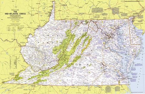
This map details the Mid-Atlantic United States. Explore the earliest English settlements in North America, Revolutionary War and Civil War sites, and the nation's capital. Published in October 1976 as part of the Close-up: U.S.A. series, with the travel poster Maryland, Virginia, Delaware, West Virginia: Beckoning Land Beside Bay and Sea and two articles on the Potomac River.
- Product Number: PODHNG_US_MID_AT_76
- Reference Product Number: 2321222M
- ISBN: - None -
- Date of Publication: 6/1/1976
- Unfolded (flat) Size: 22.75 inches high by 35 inches wide
- Map format: Wall
- Map type: Trade Maps - Wall Art
- Geographical region: United States


