
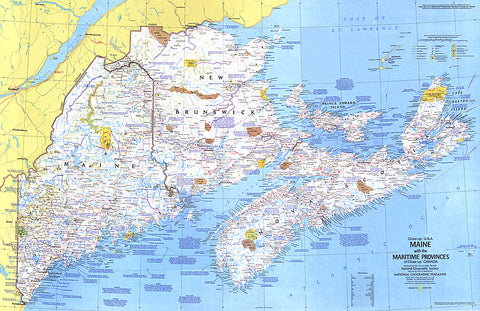
1975 Close-up USA, Maine Map
This map details Maine, the most northeastern state in the United States, as well as the surrounding Canadian maritime provinces of New Brunswick, Nova Scotia, and Prince Edward Island. Includes a wealth of notes about the festivals, events, and historical sites one can visit in this scenic region. Published in March 1975 as part of the Close-up: U.S.A. series, with a companion travel poster and an article on Nova Scotia.
- Product Number: PODHNG_US_ME_75
- Reference Product Number: 2321692M
- ISBN: - None -
- Date of Publication: 6/1/1975
- Unfolded (flat) Size: 22.75 inches high by 35 inches wide
- Map format: Wall
- Map type: Trade Maps - Wall Art
- Geographical region: United States
- Geographical subregion: Maine


