
2006 The United States, History of the Land
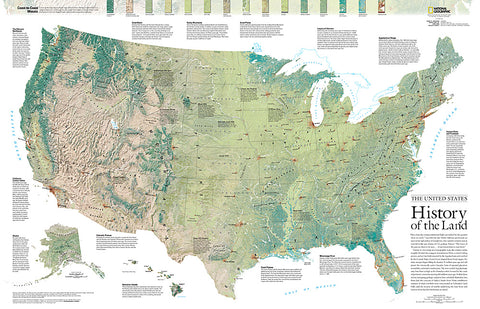
Viewed in one sweep on a topographical map, the United States seems roughly divided into a jagged mountainous West, a central rolling prairie, and an East both muscled by the Appalachians and soothed by the Coastal Plain. Grand forces of tectonic shifts, glaciation, and lava flows shaped those broad stages. This detailed physical map of the United States depicts the wide range of land cover including forests, grasslands, row crops, bare ground, wetlands and more. Published in October 2006 as half of a two–map set with a political map of the United States.
- Product Number: PODHNG_US_H_06
- Reference Product Number: 2321657M
- ISBN: - None -
- Date of Publication: 6/1/2006
- Unfolded (flat) Size: 24 inches high by 37.25 inches wide
- Map format: Wall
- Map type: Trade Maps - Historical
- Geographical region: United States


