
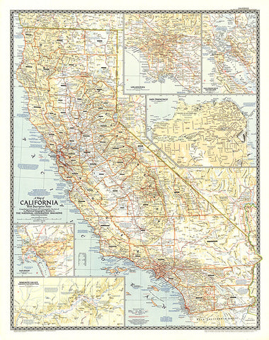
1954 California
This attractive map of California was the first map National Geographic published of The Golden State. California is the third largest state by land area and the most populous state in the United States. Its diverse places of interest are highlighted with descriptive notes. Insets reveal detail of the largest cities—Los Angeles, San Francisco, and San Diego—in addition to the San Francisco Bay Region and the Yosemite Valley. Published in June 1954.
- Product Number: PODHNG_US_CA_54
- Reference Product Number: 2321678M
- ISBN: - None -
- Date of Publication: 6/1/1954
- Unfolded (flat) Size: 38 inches high by 30 inches wide
- Map format: Wall
- Map type: Trade Maps - Political
- Geographical region: United States
- Geographical subregion: California


