
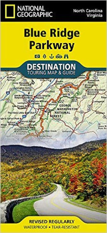
Blue Ridge Parkway Destination Map
• Waterproof • Tear-Resistant • Travel Map
The Blue Ridge Parkway is a winding route that traverses some of Americas most picturesque scenery. The Parkway is Americas most visited National Park unit and when combined with Skyline Drive through Shenandoah National Park, also covered in detail on this map, a travel experience of over almost 600 miles is created. The Blue Ridge Parkway starts in the south at the foot of the Great Smoky Mountains and runs along the Blue Ridge through several National Forests from North Carolina and into Virginia.
Destination Maps combine finely detailed maps with fascinating and practical travel information. The front side features a large-scale map of the Blue Ridge Parkway in North Carolina and Virginia and Skyline Drive in Virginia, richly layered with travel information and beautiful photographs showcasing some of many ways travelers can experience the road known as Americas Favorite Drive. In addition to the easy-to-read map on the fron
- Product Number: NG_DM_BLUE_22
- Reference Product Number: - None -
- ISBN: 9781597756242
- Date of Publication: 6/1/2022
- Folded Size: 9.45 inches high by 4.33 inches wide
- Unfolded (flat) Size: 37.4 inches high by 25.59 inches wide
- Map format: Folded
- Map type: Trade Maps - Tourist
- Geographical region: United States
- Geographical subregion: North Carolina,Virginia


