
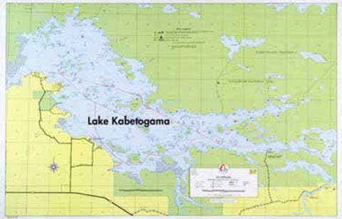
E-17: KABETOGAMA LAKE HYDROGRAPHIC
A large scale map of Kabetogama showing Coast Guard buoys, reefs, and shallows. Lake bottom contours are shown at depth intervals of 10 fee
- Product Number: FSHR_E17
- Reference Product Number: - None -
- ISBN: - None -
- Unfolded (flat) Size: 22 inches high by 34 inches wide
- Map format: Wall
- Map type: Trade Maps - Fishing
- Geographical region: United States
- Geographical subregion: Minnesota


