
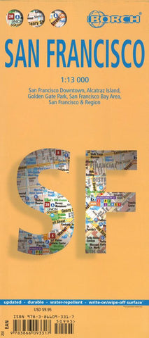
San Francisco City Map
Very clear, indexed street plan of San Francisco from Borch on durable laminated paper, showing downtown San Francisco at 1:13,000, with a plan of Golden Gate Park and general road map of the Bay Area on the reverse. Detail includes one-way streets, notable buildings, public buildings, shopping malls, pedestrian zones, tram lines, railway lines and stations, and ferry links. Symbols denote information centres, monuments, places of worship, theatres, sites of interest, car parks, hospitals, hotels, bus stations and post offices.
The main map coverage extends from the South Beach Harbour westwards to Golden Gate Bridge, and from Fisherman’s wharf southwards to Potrero Hill district. The Golden Gate Park inset is at the same scale. The Bay Area road map is at 1:400,000 and shows the main road and rail communications. A more detailed map at 1:150,000 shows the city from Golden Gate Bridge to the airport. Thirty recommended attractions are highlighted on the maps. All the maps are in
- Product Number: BOR_SAN_FR_18
- Reference Product Number: 2256514M
- ISBN: 9783866093317
- Date of Publication: 6/1/2018
- Folded Size: 9.45 inches high by 4.33 inches wide
- Unfolded (flat) Size: 25.98 inches high by 19.69 inches wide
- Map format: Folded
- Map type: Trade Maps - City Maps
- Geographical region: United States
- Geographical subregion: California


