
Lewis & Clark Bicycle Trail #4
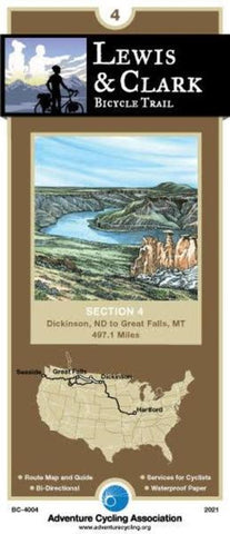
The fourth section of the Lewis & Clark Bicycle Trail begins in Dickinson, North Dakota. The route follows the I-94 corridor, alternating between the freeway and parallel county roads. In eastern Montana it stays south of the Missouri River. This part of Fort Peck Lake/Missouri River carries many additional designations: the Charles M. Russell National Wildlife Refuge, the Upper Missouri National Wild and Scenic River and, most recently, the Upper Missouri River Breaks National Monument. There are very few access roads down to the river on this map section. If youd like a closer look, check with one of the many guides listed on the map that offer tours. Services are few and far between through eastern Montana; you will want to plan your days accordingly. The terrain continues to be rolling to hilly; by the sections end in Great Falls youll be able to see the Front Range of the Rockies on the western horizon.; ; ; ABOUT ADVENTURE CYCLING MAPS ; Adventure Cycling maps are created by c
- Product Number: ADCY_BC_4004_21
- Reference Product Number: - None -
- ISBN: 9780935108682
- Date of Publication: 10/1/2021
- Folded Size: 8.25 inches high by 3.75 inches wide
- Unfolded (flat) Size: 24 inches high by 18 inches wide
- Map format: Folded
- Map type: Trade Maps - Bicycling
- Geographical region: United States
- Geographical subregion: Montana,North Dakota


