
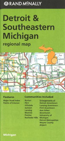
Detriot and Southeastern Michigan by Rand McNally
Rand McNallys folded map for Detroit is a must-have for anyone traveling in and around the Detroit area and Southeastern part of Michigan, offering unbeatable accuracy and reliability at a great price. Trusted cartography shows all Interstate, U.S., state, and county highways, along with clearly indicated parks, points of interest, airports, county boundaries, and streets. The easy-to-use legend and detailed index make for quick and easy location of destinations.
Regularly updated
Full-color maps
Clearly labeled Interstate, U.S., state, and county highways
Indications of parks, points of interest, airports, county boundaries, downtown & vicinity maps
Easy-to-use legend
Detailed index
Enlargements of Detroit downtown, Lansing downtown, Flint downtown, Ann Arbor downtown, University of Michigan, Detroit Metropolitan, Wayne County Airport
Convenient folded size
©2013
Communities Included: Burton, Flint, Hillsdale, Jackson, Lansing, Monroe, Pontiac, Rochester Hills
- Product Number: 2141101M
- Product Code: RM_DET
- ISBN: 9780528007989
- Year of Publication: 2013
- Folded Size: 9.06 x 4.33 inches
- Unfolded Size: 38.58 x 26.77 inches
- Map type: Folded Map
- Geographical region: United States


