
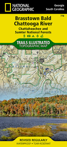
Chattahoochee and Sumter National Forests, GA/SC, Map 778 by National Geographic Maps
• Waterproof • Tear-Resistant • Topographic Map
Located just north of Atlanta, the Chattahoochee National Forest contains the southern terminus of the Appalachian Trail along with an abundance of recreational opportunities for outdoor enthusiasts of all interests.
This recreation map contains carefully researched trails, campsites, forest service roads, and points-of-interests.
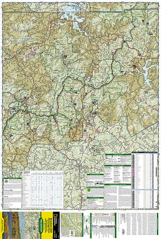
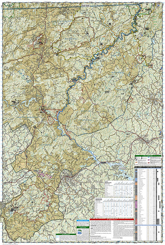
Useful UTM and Latitude/Longitude grids, mileage charts, and other navigation features make Brasstown Bald/Chattooga River the best map available for this section of the Chattahoochee National Forest.
The West Side of the Map Includes: Chatuge Lake, Lake Burton, Brasstown National Wilderness, Chattahoochee Wildlife Management Area, Raven Cliffs Wilderness, Blood Mountain Wilderness, Cooper Creek Wildlife Management Area, Anna Ruby Falls Scenic Area, Tray Mountain Wilderness, Swallow Creek Wildlife Management Area, Lake Burton Wildlife Management Area, Southern tip of the Nantahala Wilderness, High Shoals Scenic Area, Unicoi State Park, Smithgall Woods- Dukes Creek Conservation Area, Hardman Farm HS, Mount Yonah, Blood Mountain Wilderness, and more..
The East Side of the Map Includes: Ellicott Rock Wilderness, White Rock Scenic Area, Warwoman Wildlife Management Area, Black Rock Mountain State Park, Chattooga Wild and Scenic River, Sumter National Forest, Tallujah Gorge State Park, Brasstown Creek State Heritage Preserve, Hartwell Reservoir, Lake Russell State Wildlife Management Area, and more...
Map Scale = 1:70,000
- Product Number: 2034587M
- Product Code: TI_BRASSTOWN
- Publisher Product ID: TI00000778
- ISBN: 9781566954679
- Year of Publication: 2009
- Folded Size: 9.45 x 4.33 inches
- Unfolded Size: 37.01 x 24.8 inches
- Map type: Folded Map
- Geographical region: United States


