
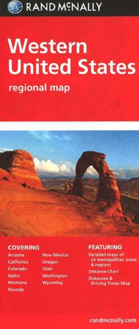
United States, Western Regional by Rand McNally
Regularly updated, full-color maps
Clearly labeled Interstate, U.S., state, and county highways
Detail maps of major cities, a mileage chart, and a Mileages & Driving Times Map
Indications of parks, points of interest, airports, county boundaries, and more
Easy-to-use legend
Detailed index
Convenient folded size
States covered: Arizona, California, Colorado, Idaho, Montana, Nevada, New Mexico, Oregon, Utah, Washington, Wyoming
- Product Number: 2031058M
- Product Code: RM_EASY_USA_W
- ISBN: 9780528882111
- Year of Publication: 2014
- Folded Size: 9.45 x 4.33 inches
- Unfolded Size: 31.89 x 26.38 inches
- Map type: Folded Map
- Geographical region: United States


