
Wasatch Front, North, Map 709
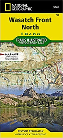
Year-round activities abound along Utah’s Wasatch Front region. This map features key points of interest including Salt Lake City; Strawberry and Deer Creek reservoirs; Strawberry River; Heber City; Timpanogos Cave National Monument; Orem; Utah Lake; Jordanelle, Rockport, East Canyon, and Wasatch Mountain state parks; and Weber River.
This map can guide you off the beaten path and back again with miles of mapped trails including a portion of the Great Western Historic Trail and the Historic Union Pacific Rail Trail. Trail use designations and mileages are clearly marked. Alpine Loop, Big Cottonwood Canyon, and other scenic byways are noted for those taking in the scenery by car. Picnic sites in Mill Creek and Big Cottonwood canyons are marked and a handy camping guide shows campground locations, elevation, amenities, and number of sites at each. Some of the many recreation features include boat launches, trailheads, interpretive trails, swimming and fishing areas, snow parks, an
- Product Number: TI_WASATCH_N_20
- Reference Product Number: - None -
- ISBN: 9781566953702
- Date of Publication: 6/1/2020
- Folded Size: 9.45 inches high by 4.33 inches wide
- Unfolded (flat) Size: 25.2 inches high by 37.2 inches wide
- Map format: Folded
- Map type: Trade Maps - Park
- Geographical region: United States
- Geographical subregion: Utah


