
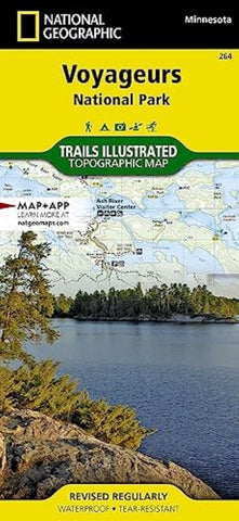
Voyageurs National Park
Located at the border of Minnesota and Canada, Voyageurs National Park is defined by its interconnected waterways which require you to leave your car behind and explore by kayak, canoe, houseboat, or motorboat. In winter, snowmobiles, snowshoes, and skis will be your mode of travel in this extraordinary wilderness. National Geographic’s Trails Illustrated map of Voyageurs National Park combines unmatched detail with helpful information to offer an invaluable tool for making the most of your visit to this inspiring region. This map features key park attractions including Gull Island Rookery; Grassy Bay Cliffs; Anderson Bay; Kettle Falls; Hoist Bay; Gold Portage; and the Ash River, Kabetogama Lake, and Rainy Lake Visitor Centers.
Designed with a wide range of visitors in mind, this map features detailed and easy-to-read trails, accurate road network, visitor centers and facilities, safety tips, recreation opportunities, plus information on park fees, reservations, and permits. An
- Product Number: TI_VOYAGEURS_23
- Reference Product Number: - None -
- ISBN: 9781566955041
- Date of Publication: 6/1/2023
- Folded Size: 9.45 inches high by 4.33 inches wide
- Unfolded (flat) Size: 37.01 inches high by 24.8 inches wide
- Map format: Folded
- Map type: Trade Maps - Park
- Geographical region: United States
- Geographical subregion: Minnesota


