
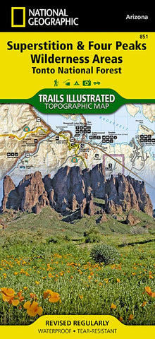
Superstition and Four Peaks Wilderness Areas, Map 851
• Waterproof • Tear-Resistant • Topographic Map
One of the largest national forests in the United States, Tonto National Forest is known not only for its diversity of terrain, flora and fauna but also for its numerous recreational opportunities throughout the year. Expertly researched and created in cooperation with the U.S. Forest Service and others, National Geographics Trails Illustrated map of Superstition and Four Peaks Wilderness Areas provides extensive detail of this area of the forest. The maps coverage includes Bartlett Reservoir, McDowell Mountain Regional Park, McDowell Sonoran Preserve, Verde and Salt Rivers, Saguaro and Apache Lakes, Roosevelt Lake and Wildlife Area and Tonto National Monument.
Whether you explore the area on foot, bike, horseback or motorized vehicle, you can get off the beaten path and back on again by following the map to clearly marked trailheads and then along precisely mapped trails that are color-coded according to their designated
- Product Number: TI_SUPERSTITI_19
- Reference Product Number: - None -
- ISBN: 9781566954853
- Date of Publication: 6/1/2019
- Folded Size: 9.45 inches high by 4.33 inches wide
- Unfolded (flat) Size: 24.8 inches high by 37.01 inches wide
- Map format: Folded
- Map type: Trade Maps - Park
- Geographical region: United States
- Geographical subregion: Arizona


