
Springer and Cohutta Mountains, Map 777
• Waterproof • Tear-Resistant • Topographic Map
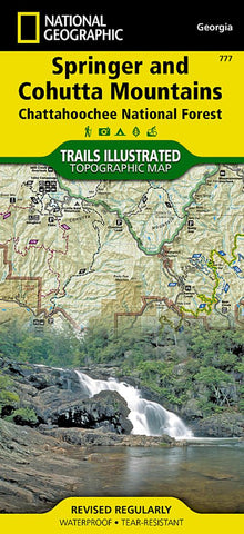
An abundance of recreational opportunities abound in the Chattahoochee National Forest, just north of Atlanta. National Geographic’s Trails Illustrated map of Springer and Cohutta Mountains delivers extensive detail and valuable information to assist you in your exploration of these regions of the forest. Expertly researched and created in partnership with local land management agencies, this map features key points of interest including Blue Ridge, Nottely and Conasauga lakes; Fort Mountain and Amicalola state parks; Whissenhunt Mountain; Coosawattee Wildlife Management Area; Ed Jenkins National Recreation Area, and more.
Narrow down the best places to visit according to your needs and interests with the handy activity guide. An extensive trail chart will help you choose a trail that’s right for your activity level and recreation use whether you’re traveling by foot, horse, mountain bike, or motorized vehicle. Miles of trai
- Product Number: TI_SPRINGER_20
- Reference Product Number: - None -
- ISBN: 9781566954662
- Date of Publication: 6/1/2020
- Folded Size: 9.45 inches high by 4.33 inches wide
- Unfolded (flat) Size: 24.8 inches high by 33.07 inches wide
- Map format: Folded
- Map type: Trade Maps - Park
- Geographical region: United States
- Geographical subregion: Georgia


