
Pisgah Ranger District and Pisgah National Forest, Map 780
• Waterproof • Tear-Resistant • Topographic Map
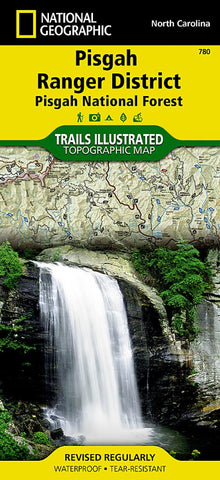
Home of the first school of forestry and containing two of the first designated wilderness areas in the eastern United States, Pisgah National Forest is a remarkable land of hardwood forests, mile-high peaks, whitewater rivers, and cascading waterfalls. National Geographics Trails Illustrated map of Pisgah Ranger District, Pisgah National Forest delivers extensive detail and valuable information to assist you in your exploration of this breathtaking wilderness that spans over 500,000 acres. Expertly researched and created in partnership with local land management agencies, this map features key points of interest including Shining Rock and Middle Prong wilderness areas, North Carolina Arboretum, Cradle of Forestry in America National Historic Site, Blue Ridge Parkway, Cold Mountain, and more.
The Forest Service and North Carolina scenic byways are noted for those wishing to take in the scenery by car. Hundreds of miles of tra
- Product Number: TI_PISGAH_20
- Reference Product Number: - None -
- ISBN: 9781566953320
- Date of Publication: 6/1/2020
- Folded Size: 9.45 inches high by 4.33 inches wide
- Unfolded (flat) Size: 33.07 inches high by 24.8 inches wide
- Map format: Folded
- Map type: Trade Maps - Park
- Geographical region: United States
- Geographical subregion: North Carolina


