
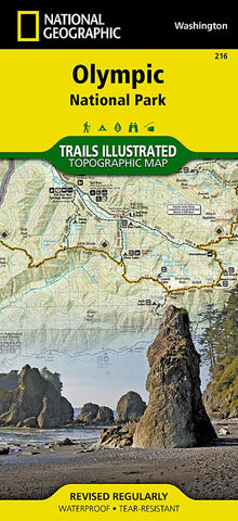
Olympic National Park, Map 216
• Waterproof • Tear-Resistant • Topographic Map
Olympic National Park encompasses four distinctly different ecosystems in its nearly one million acres. National Geographic’s Trails Illustrated map of Olympic National Park offers outdoors enthusiasts a valuable tool for exploring the park’s old-growth forests, glaciers, untamed rivers, and rugged coastline. Expertly researched and created in partnership with local land management agencies, this map features key areas of interest including Mount Olympus, Ozette Lake, Olympic National Forest, Lake Quinalt, Mount Skokomish Wilderness, Hurricane Ridge, Lake Crescent, and more.
With miles of mapped trails including a portion of the Pacific Northwest Trail, this map can guide you off the beaten path and back again in some of the most breathtaking scenery in the region. Designed with a wide range of visitors in mind, this map features detailed and easy to read trails, accurate road network, points of interest, lodging, waterfalls
- Product Number: TI_OLYMPIC_22
- Reference Product Number: - None -
- ISBN: 9781566954020
- Date of Publication: 6/1/2019
- Folded Size: 9.45 inches high by 4.33 inches wide
- Unfolded (flat) Size: 24.8 inches high by 37.01 inches wide
- Map format: Folded
- Map type: Trade Maps - Park
- Geographical region: United States
- Geographical subregion: Washington


