
Okefenokee National Wildlife Refuge Map
• Waterproof • Tear-Resistant • Topographic Map
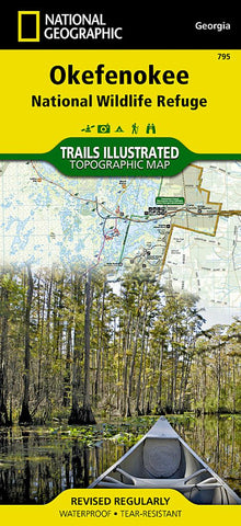
This map offers details for the entire park and features key areas of interest including Stephen C. Foster State Park, Suwannee River Sill Recreation Area, Okefenokee Swamp Park, Kingfisher Landing, and Laura S. Walker State Park.
Designed with a wide range of visitors in mind, this map features detailed topography with shaded relief and vegetation classification, an accurate road network including Okefenokee Trail and Swamp Island Drive auto tours, visitor centers and facilities, safety tips, and agency contact information. Paddling is the best way to explore the refuge in depth, and this map is loaded with information specific to that activity including color-coded canoe trails, trail mileage, difficulty ratings, and charts of canoe trails and overnight canoe trips. Many recreation features are noted as well, including campgrounds, boat ramps, shooting ranges, and areas for wildlife viewing, water skiing, biking, paddling,
- Product Number: TI_OKEFENOKEE_20
- Reference Product Number: - None -
- ISBN: 9781566956277
- Date of Publication: 6/1/2020
- Folded Size: 9.45 inches high by 4.33 inches wide
- Unfolded (flat) Size: 33.07 inches high by 24.8 inches wide
- Map format: Folded
- Map type: Trade Maps - Park
- Geographical region: United States
- Geographical subregion: Georgia


