
Mt. Jefferson and Mt. Washington Wilderness, Map 819
• Waterproof • Tear-Resistant • Topographic Map
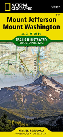
The Mount Jefferson and Mount Washington Wilderness Areas are characterized by picturesque mountains, glaciers, alpine meadows, pine and fir forests, and over 175 lakes. National Geographic’s Trails Illustrated map of Mount Jefferson and Mount Washington features key points of interest including Menagerie Wilderness; Detroit, Suttle, Clear, Marion, and Blue River lakes; McKenzie and Metolius rivers; and Santiam Pass Summer OHV Area.
With hundreds of miles of mapped trails including portions of the Pacific Crest National Scenic Trail, Metolius-Windigo Trail, Lava River National Recreation Trail, this map can guide you off the beaten path and back again. Trail use is easy to identify, whether you’re hiking, biking, horseback riding, or OHVing. The McKenzie Pass–Santiam Pass and West Cascades scenic byways are noted for those wishing to take in the scenery by car. Many recreation features are noted as well, including campground
- Product Number: TI_MT_JEFFERSON_19
- Reference Product Number: - None -
- ISBN: 9781566956635
- Date of Publication: 6/1/2019
- Folded Size: 9.45 inches high by 4.33 inches wide
- Unfolded (flat) Size: 24.8 inches high by 37.01 inches wide
- Map format: Folded
- Map type: Trade Maps - Park
- Geographical region: United States
- Geographical subregion: Oregon


