
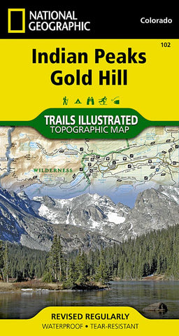
Indian Peaks and Gold Hill, Map 102
• Waterproof • Tear-Resistant • Topographic Map
National Geographic’s Trails Illustrated map of Indian Peaks, Gold Hill combines unmatched detail with helpful information to offer an invaluable tool for enjoying the variety of recreation opportunities available in this section of the Rocky Mountains. Expertly researched and created in partnership with local land management agencies, this map features key points of interest including Indian Peaks Wilderness, Arapaho National Forest, Arapaho National Recreation Area, Gold Hill, Nederland, and the scenic Peak to Peak Highway.
With miles of mapped trails including the Continental Divide Trail, this map can guide you off the beaten path and back again in some of the most breathtaking scenery in Colorado. Cyclists will appreciate the detail paid to the many hard surface and mountain bike trails in the region. The map base includes contour lines and elevations for summits, passes and many lakes. Recreation features are clearly m
- Product Number: TI_INDIAN_PEAKS_19
- Reference Product Number: 2034570M
- ISBN: 9781566952750
- Date of Publication: 6/1/2019
- Folded Size: 7.48 inches high by 3.94 inches wide
- Unfolded (flat) Size: 20.47 inches high by 25.98 inches wide
- Map format: Folded
- Map type: Trade Maps - Park
- Geographical region: United States
- Geographical subregion: Colorado


