
Canyons of the Escalante : Grand Staircase-Escalante, NM : Trails illustrated : topographic map
Waterproof, tear-resistant, topographic map.
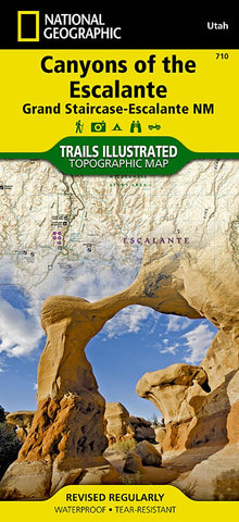
At over 1.7 million acres, Grand Staircase-Escalante National Monument encompasses the largest land area of all national monuments in the United States. National Geographics Trails Illustrated map of Canyons of the Escalante delivers unmatched detail and valuable information to assist you in your exploration of this remote and colorful wilderness. Expertly researched and created in partnership with local land management agencies, this map features key points of interest including Fiftymile Bench, Escalante Petrified Forest State Park, Anasazi State Park Museum, and Horse Canyon.
Hiking route summaries will guide you off the beaten path and back again and high clearance and four-wheel-drive roads are clearly marked to keep you out of trouble. River mileage on the Escalante River is noted as well, for those exploring the canyons by boat. The map base includes contour lines and elevations for summits. Recreation features include
- Product Number: TI_ESCALAN_19
- Reference Product Number: 2034633M
- ISBN: 9781566953245
- Date of Publication: 6/1/2019
- Folded Size: 9.45 inches high by 4.33 inches wide
- Unfolded (flat) Size: 37.2 inches high by 25.2 inches wide
- Map format: Folded
- Map type: Trade Maps - Park
- Geographical region: United States
- Geographical subregion: Utah


