
Denali National Park, Map 222
• Waterproof • Tear-Resistant • Topographic Map
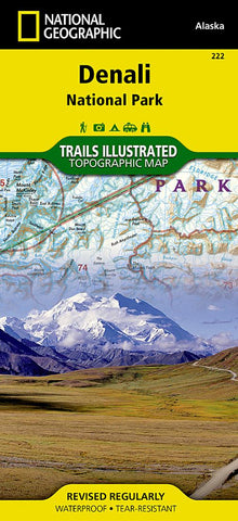
Denali National Park and Preserve covers a staggering six million acres of truly wild and pristine wilderness, bisected by a single road. The crown jewel of the park is the towering 20,320 foot Mount McKinley, North America’s tallest peak. Key areas of interest featured on this map include Denali State Park; Kroto, Moose Creek, and Lake Creek recreation rivers; Lake Minchumina; and the Kantishna Mining District. The print version of the map includes a detailed inset of the park entrance and headquarters.
If you wish to camp in the park, a chart of campground information that includes the distance from the entrance, number and type of spaces, facilities, access, and contact information for making your reservations will help you plan your stay. Private vehicle travel in the park is limited, but this map’s coverage of the shuttle bus system will ensure you have the knowledge you need to access the entire park. Helpful informati
- Product Number: TI_DENALI_19
- Reference Product Number: - None -
- ISBN: 9781566953283
- Date of Publication: 6/1/2019
- Folded Size: 9.45 inches high by 4.33 inches wide
- Unfolded (flat) Size: 24.8 inches high by 37.01 inches wide
- Map format: Folded
- Map type: Trade Maps - Park
- Geographical region: United States
- Geographical subregion: Alaska


