
Crystal Basin, Silver Fork and Eldorado National Forest, Map 806
• Waterproof • Tear-Resistant • Topographic Map
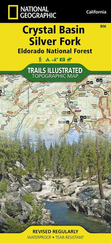
National Geographic’s Trails Illustrated map of Crystal Basin and Silver Fork covers the Eldorado National Forest, from its northern boundary with Tahoe National Forest to its southern boundary with Stanislaus National Forest. The map provides both unmatched detail and valuable information for outdoor enthusiasts exploring this part of California’s Sierra Nevada. Expertly researched and created in partnership with the U.S. Forest Service and others, this map features key points of interest including Mokelumne and Desolation Wildernesses, Hell Hole and Union Valley Reservoirs, Silver Lake and Kirkwood Ski Area. An informative summary of each wilderness area, safety tips, including a special section on bear safety tips, recreation tips and agency contact information are included as well.
The areas many trails are clearly marked and color coded according to their designated usage, whether you’re exploring on foot, horseback, b
- Product Number: TI_CRYSTAL_20
- Reference Product Number: 2034539M
- ISBN: 9781566952644
- Date of Publication: 6/1/2020
- Folded Size: 9.45 inches high by 4.33 inches wide
- Unfolded (flat) Size: 37.01 inches high by 24.8 inches wide
- Map format: Folded
- Map type: Trade Maps - Park
- Geographical region: United States
- Geographical subregion: California


