
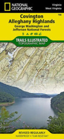
Covington and Alleghany Highlands, Virginia
Explore the natural beauty, historical sites, and many recreation opportunities available along the border regions of Virginia and West Virginia with National Geographic’s Trails Illustrated map of Covington and Alleghany Highlands. Created in partnership with local land management agencies, this expertly researched map delivers unmatched detail and helpful information for experienced outdoor enthusiasts and casual visitors alike. Some of the key areas of interest included are Lake Moomaw; Douthat and Moncove Lake state parks; Eastern National Children’s Forest; Jackson and Cowpasture Rivers; the towns of Covington, Clifton Forge, and New Castle; and Rough Mountain, Mountain Lake, Rich Hole, Barbours Creek, and Shawvers Run wilderness areas.
With miles of mapped trails including portions of the Appalachian and Alleghany Highlands trails, this map can guide you off the beaten path and back again in some of the most breathtaking scenery in the region. An extensive trail chart will
- Product Number: TI_COVINGTON_20
- Reference Product Number: - None -
- ISBN: 9781566951173
- Date of Publication: 6/1/2020
- Folded Size: 9.45 inches high by 4.33 inches wide
- Unfolded (flat) Size: 37.2 inches high by 25.2 inches wide
- Map format: Folded
- Map type: Trade Maps - Park
- Geographical region: United States
- Geographical subregion: Virginia


