
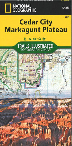
Cedar City, Markagunt Plateau : trails illustrated topographic maps
• Waterproof • Tear-Resistant • Topographic Map Cedar City is the headquarters of the Dixie National Forest which is a two-million-acre, 170-mile stretch of breathtaking wilderness across southern Utah. This map covers the Markagunt OHV Trail System from the stunning Pink Cliffs in the South to the Parowon Valley Northwest to the town of Panguitch in the East, and the spectacular Markagunt Plateau Scenic Drive—a 123-mile trail from Cedar City to Parowan. Also featured are Cedar Breaks National Monument—with meadows at 10,000 feet and stunning nights for stargazing—as well as the shallow Navajo Lake, ideal for fishing, swimming, and boating, and the red limestone Hurricane Cliffs. The area offers boundless outdoor recreation opportunities, from hiking, hunting, and horseback riding to skiing, swimming, and scenic driving—for all seasons, and a wide range of visitors. Recreation features are clearly marked, including trailheads, campgrounds, boat launches, mountain bike routes, ATV trail
- Product Number: TI_CEDAR_MAR_20
- Reference Product Number: - None -
- ISBN: 9781566953061
- Date of Publication: 6/1/2020
- Folded Size: 9.45 inches high by 4.33 inches wide
- Unfolded (flat) Size: 36.81 inches high by 24.41 inches wide
- Map format: Folded
- Map type: Trade Maps - Park
- Geographical region: United States
- Geographical subregion: Utah


