
Bend and Three Sisters, OR, Map 818
• Waterproof • Tear-Resistant • Topographic Map
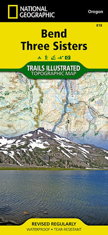
National Geographics Trails Illustrated map of Bend and Smith Rock is a two-sided, waterproof map designed to meet the needs of outdoor enthusiasts with durability and detail. This map was created in conjunction with local land management agencies and is loaded with valuable recreation information.
Trails Illustrated maps are expertly researched and frequently updated. The maps are printed in the United States on durable synthetic paper, making them waterproof, tear-resistant, and trail tough — capable of going anywhere you do.
Key Features:
- Waterproof and tear-resistant
- Clearly marked trails for hiking, biking, horseback riding, ATV, and more
- Detailed topography and clearly defined, color-coded boundaries of state parks, national recreation areas, wilderness areas, marine sanctuaries and wildlife refuges
- Hundreds of points-of-interest, including scenic viewpoints, campgrounds, boat launches and ca
- Product Number: TI_BEND_19
- Reference Product Number: - None -
- ISBN: 9781566956628
- Date of Publication: 6/1/2019
- Folded Size: 9.45 inches high by 4.33 inches wide
- Unfolded (flat) Size: 24.41 inches high by 36.61 inches wide
- Map format: Folded
- Map type: Trade Maps - Park
- Geographical region: United States
- Geographical subregion: Oregon


