
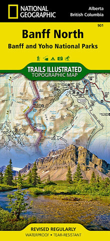
Banff north : Banff and Yoho National Parks
• Waterproof • Tear-Resistant • Topographic Map
National Geographics Trails Illustrated map of Banff North delivers extensive detail for outdoor enthusiasts exploring the unparalleled mountain scenery and abundance of recreational opportunities of the Canadian Rockies. Expertly researched and created in cooperation with Parks Canada and others, the map covers the northern and western areas of Banff National Park as well as Yoho and Kootenay National Parks, Siffleur and White Goat Wilderness Areas, Kootenay Plains Provincial Park and the southeastern tip of Jasper National Park. Many popular recreation points of interest are shown, including Lakes Louise and OHara as well as the scenic Icefields Parkway, displayed with distance markers.
Explore the area by following the map to trailheads and then along precisely mapped trails, shown with distance markers in miles and kilometers and labeled for hiking, biking and horseback riding. To aid in your navigation the map shows g
- Product Number: TI_BANFF_N_20
- Reference Product Number: - None -
- ISBN: 9781566956598
- Date of Publication: 6/1/2020
- Folded Size: 9.45 inches high by 4.33 inches wide
- Unfolded (flat) Size: 37.01 inches high by 24.8 inches wide
- Map format: Folded
- Map type: Trade Maps - Park
- Geographical region: Canada
- Geographical subregion: Alberta,British Columbia


