
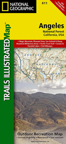
Angeles National Forest : California, USA
National Geographics Trails Illustrated map of Angeles National Forest is a two-sided, waterproof map designed to meet the needs of outdoor enthusiasts with durability and detail. This map was created in conjunction with local land management agencies and is loaded with valuable recreation information.
Trails Illustrated maps are expertly researched and frequently updated. The maps are printed in the United States on durable synthetic paper, making them waterproof, tear-resistant, and trail tough, capable of going anywhere you do. The map is two-sided, and can be folded to a packable size of 4.25 x 9.25; unfolded size is 26 x 38.
Net proceeds from the sale of this map go to support the nonprofit mission of the National Geographic Society.
Key Features:
- Waterproof and tear-resistant
- Clearly marked trails for hiking, biking, horseback riding, and more
- Detailed topography and clearly defined, color-coded boundaries of state parks, national re
- Product Number: TI_ANGELES_20
- Reference Product Number: - None -
- ISBN: 9781566955775
- Date of Publication: 6/1/2020
- Folded Size: 9.45 inches high by 4.33 inches wide
- Unfolded (flat) Size: 37.01 inches high by 24.8 inches wide
- Map format: Folded
- Map type: Trade Maps - Park
- Geographical region: United States
- Geographical subregion: California


