
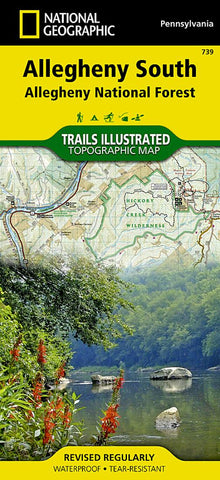
Allegheny National Forest, South, Map 739
Explore the forests, valleys, and winding rivers of northwestern Pennsylvania with National Geographics Trails Illustrated map of Allegheny South. Expertly researched and created in partnership with local land management agencies, this map is a valuable tool for those seeking a relaxing day trip and outdoor adventurers alike. Key areas of interest featured on this map include Hickory Creek Wilderness; Elk, Oil Creek, Cook Forest, and Clear Creek state parks; Buzzard Swamp; Allegheny Islands Wilderness; and Tionesta and Hearts Content scenic areas.
Like all Trails Illustrated maps, this map features detailed topography with shaded relief, elevations, and clearly defined, color-coded boundaries for parks, forests, wilderness areas, and wildlife management areas. With miles of mapped hiking, biking, snowmobile, equestrian, and cross-country ski trails including a portion of the North Country Trail and the Allegheny Snowmobile Loop, this map can guide you off the beaten path and ba
- Product Number: TI_ALLEGH_S_20
- Reference Product Number: - None -
- ISBN: 9781566956321
- Date of Publication: 6/1/2020
- Folded Size: 9.45 inches high by 4.33 inches wide
- Unfolded (flat) Size: 24.8 inches high by 37.01 inches wide
- Map format: Folded
- Map type: Trade Maps - Park
- Geographical region: United States
- Geographical subregion: Pennsylvania


