
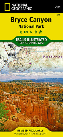
Bryce Canyon National Park, Utah, Map 219 by National Geographic Maps
Waterproof, tear-resistant, topographic map of Bryce Canyon.
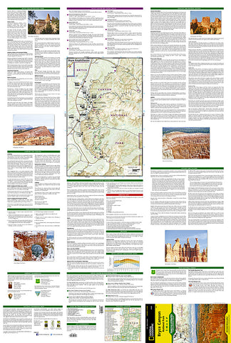
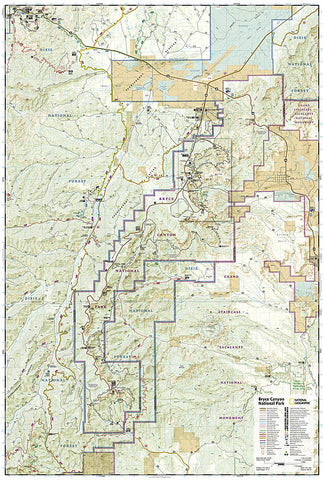
Created in partnership with local land management agencies, this expertly researched map will help you get the most from your visit with backpacking and day hike trail summaries, accurate road network, trailheads, campgrounds, lodging, and scenic viewpoints. The map features many key points of interest including Rainbow Point, Rubys Inn, and Natural Bridge. Portions of Grand Staircase - Escalante National Monument and Dixie National Forest are included as well. Includes an inset of Bryce Amphitheater, information on the parks geology, natural history, weather, history and culture, regulations, and more. With miles of mapped trails including Great Western Trail, cross-country ski trails, and horse routes, this map can guide you off the beaten path and back again in some of the most breathtaking scenery in the region. Mileages between intersections are shown and the map base includes contour lines and elevations for summits and passes.
Every Trails Illustrated map is printed on Backcountry Tough waterproof, tear-resistant paper. A full UTM grid is printed on the map to aid with GPS navigation.
Other features found on this map include: Bryce Canyon National Park, Dixie National Forest, Pink Cliffs.
- Product Number: 2144314M
- Product Code: TI_BRYCE
- Publisher Product ID: TI00000219
- ISBN: 9781566953207
- Year of Publication: 2016
- Folded Size: 9.45 x 4.330 inches
- Unfolded Size: 24.8 x 37.01 inches
- Map type: Folded Map
- Geographical region: Utah


