
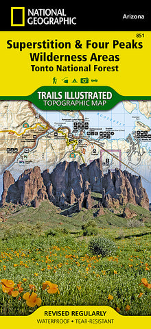


Superstition and Four Peaks Wilderness Areas, Map 851 by National Geographic Maps
• Waterproof • Tear-Resistant • Topographic Map
One of the largest national forests in the United States, Tonto National Forest is known not only for its diversity of terrain, flora and fauna but also for its numerous recreational opportunities throughout the year. Expertly researched and created in cooperation with the U.S. Forest Service and others, National Geographics Trails Illustrated map of Superstition and Four Peaks Wilderness Areas provides extensive detail of this area of the forest. The maps coverage includes Bartlett Reservoir, McDowell Mountain Regional Park, McDowell Sonoran Preserve, Verde and Salt Rivers, Saguaro and Apache Lakes, Roosevelt Lake and Wildlife Area and Tonto National Monument.
Whether you explore the area on foot, bike, horseback or motorized vehicle, you can get off the beaten path and back on again by following the map to clearly marked trailheads and then along precisely mapped trails that are color-coded according to their designated usage. The Arizona Trail and Great Western Trail are both highlighted. Among the many map features are contour lines and elevations, lakes, rivers and other water features and numbered forest service roads. Recreation points of interest cover the map, including campgrounds, swimming and fishing areas, boat launch and river access points, horse camps and stables, interpretive trails and scenic viewpoints. The map also includes background information about the national forest and wilderness areas, a recreation guide, regulations about lake and reservoir usage, safety tips and essential contact information.
Every Trails Illustrated map is printed on Backcountry Tough waterproof, tear-resistant paper. A full UTM grid is printed on the map to aid with GPS navigation.
Other features found on this map include: Apache Junction, Apache Lake, Bartlett Reservoir, El Mirage, Fountain Hills, Four Peaks, Four Peaks Wilderness, Mazatzal Mountains, Mesa, Saguaro Lake, Salome Wilderness, Superstition Mountains, Superstition Wilderness, Theodore Roosevelt Lake, Tonto National Forest, Verde River.
Map Scale = 1:70,000
- Product Number: 2034535M
- Product Code: TI_SUPERSTITI
- Publisher Product ID: TI00000851
- ISBN: 9781566954853
- Year of Publication: 2009
- Folded Size: 9.45 x 4.33 inches
- Unfolded Size: 37.01 x 24.8 inches
- Map type: Folded Map
- Geographical region: Arizona


