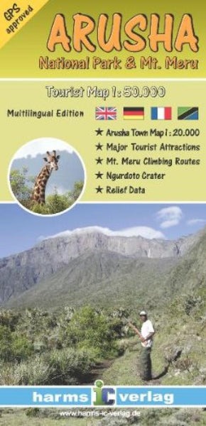
Arusha National Park & Mt. Meru
The map represents the entire National Park area from Mount Meru in the west to the Ngurdoto Crater in the East at a detailed scale of 1: 50,000. By a combination of contour lines, colored elevation layers and a greyscale relief shading an optimal terrain representation is achieved. The map is complemented by a city map of Arusha scaled 1:20,000, some color photographs and a stage table for climbing Mount Meru. All climbing routes are GPS-proven by local rangers. Multi-lingual legend: English, German, French and Kiswahili.
- Product Number: HV_ARUSHA_7
- Reference Product Number: 2033751M
- ISBN: 9783927468276
- Date of Publication: 6/1/2007
- Folded Size: 7.87 inches high by 3.94 inches wide
- Unfolded (flat) Size: 20.47 inches high by 14.17 inches wide
- Map format: Folded
- Map type: Trade Maps - Park
- Geographical region: Tanzania