Arusha National Park and Arusha, Tanzania by Harms IC Verlag
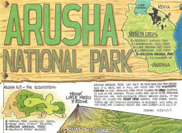
The map represents the entire National Park area from Mount Meru in the west to the Ngurdoto Crater in the East at a detailed scale of 1: 50,000. By a combination of contour lines, colored elevation layers and a greyscale relief shading an optimal terrain representation is achieved. The map is complemented by a city map of Arusha scaled 1:20,000, some color photographs and a stage table for climbing Mount Meru. All climbing routes are GPS-proven by local rangers. Multi-lingual legend: English, German, French and Kiswahili.
- Product Number: 2033751M
- Product Code: HV_ARUSHA
- ISBN: 9783927468276
- Year of Publication: 2007
- Folded Size: 7.87 x 3.94 inches
- Unfolded Size: 14.17 x 20.47 inches
- Map type: Folded Map
- Geographical region: Tanzania