
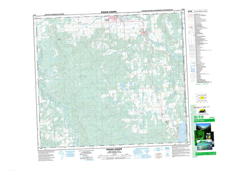
093P09 Pouce Coupe Canada topo map, 1:50,000 scale
093P09 Pouce Coupe NRCAN topographic map.
Includes UTM and GPS geographic coordinates (latitude and longitude). This 50k scale map is suitable for hiking, camping, and exploring, or you could frame it as a wall map.
Printed on-demand using high resolution, on heavy weight and acid free paper, or as an upgrade on a variety of synthetic materials.
Topos available on paper, Waterproof, Poly, or Tyvek. Usually shipping rolled, unless combined with other folded maps in one order.
- Product Number: NRCAN-093P09
- Parent Topo: TOPO-093P
- Map ID also known as: 093P09, 93P9, 93P09
- Unfolded Size: Approximately 26" high by 36" wide
- Weight (paper map): ca. 55 grams
- Map Type: POD NRCAN Topographic Map
- Map Scale: 1:50,000
- Geographical region: Alberta, Canada
Neighboring Maps:
All neighboring Canadian topo maps are available for sale online at 1:50,000 scale.
Purchase the smaller scale map covering this area: Topo-093P
Spatial coverage:
Topo map sheet 093P09 Pouce Coupe covers the following places:
- Alcock Lake - Klukas Lake - McWaters Lake - Swan Lake - Toms Lake - Bear Mountain - Peace River Regional District - Sudeten Park - Swan Lake Park - Alberta - British Columbia - Colombie-Britannique - Bissette Creek - Brassey Creek - Dawson Creek - Frondizi Creek - Kiskatinaw River - Klukas Creek - Little Brassy Creek - Little Tupper Creek - Pouce Coupé River - Reamer Creek - Reed Creek - Ski Hill Creek - South Dawson Creek - Tate Creek - Toms Creek - Tupper Creek - Tupper River - Gundy - South Dawson - Tomslake - Tupper - Upper Cutbank - Pouce Coupe


