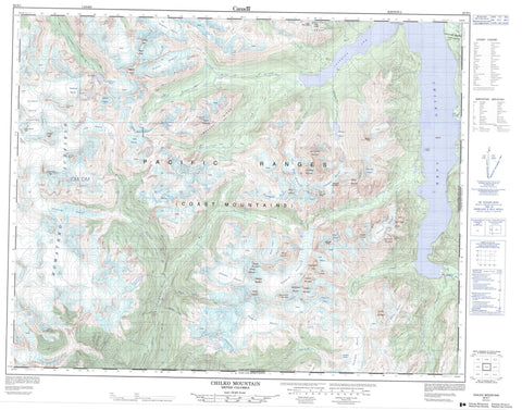
092N01 Chilko Mountain Canada topo map, 1:50,000 scale
092N01 Chilko Mountain NRCAN topographic map.
Includes UTM and GPS geographic coordinates (latitude and longitude). This 50k scale map is suitable for hiking, camping, and exploring, or you could frame it as a wall map.
Printed on-demand using high resolution, on heavy weight and acid free paper, or as an upgrade on a variety of synthetic materials.
Topos available on paper, Waterproof, Poly, or Tyvek. Usually shipping rolled, unless combined with other folded maps in one order.
- Product Number: NRCAN-092N01
- Parent Topo: TOPO-092N
- Map ID also known as: 092N01, 92N1, 92N01
- Unfolded Size: Approximately 26" high by 36" wide
- Weight (paper map): ca. 55 grams
- Map Type: POD NRCAN Topographic Map
- Map Scale: 1:50,000
- Geographical region: British Columbia, Canada
Neighboring Maps:
All neighboring Canadian topo maps are available for sale online at 1:50,000 scale.
Purchase the smaller scale map covering this area: Topo-092N
Spatial coverage:
Topo map sheet 092N01 Chilko Mountain covers the following places:
- Franklyn Arm - Bateman Point - Alidade Glacier - Alph Glacier - Austen Glacier - Cambridge Glacier - Canopus Glacier - Carlisle Glacier - Chilko Glacier - Coronel Glacier - Cradock Glacier - Cumberland Glacier - Durham Glacier - Farrow Glacier - Glasgow Glacier - Goddard Glacier - Good Hope Glacier - Hamilton Glacier - Homathko Icefield - Homathko Snowfield - Kexem Glacier - Knewstubb Glacier - Map Glacier - Merriam Glacier - Nine Mile Glacier - Norrington Glacier - Nostetuko Glacier - Otranto Glacier - Queen Bess Glacier - Roof Glacier - Southgate Glacier - Stilly Glacier - Windscoop Glacier - Zexwzaxw Glacier - Burnt Island - Chilko Lake - Frobisher Lake - Glasgow Lakes - Nostetuko Lake - Nostetuko Lakes - Tarn Lake - Admiral Ridge - Canopus Mountain - Capital Group - Chaîne Côtière - Chilcotin Ranges - Chilko Mountain - Chimney Pot Peak - Cloister Peak - Coast Mountains - Consort Peak - Coronel Mountain - Dawn Treader Mountain - Dresden Mountain - Farm Mountain - Five Brothers Peaks - Frobisher Peak - Glasgow Mountain - Good Hope Mountain - Impasse Ridge - Leipzig Mountain - Majestic Peak - Mount Cradock - Mount Durham - Mount Farrow - Mount Good Hope - Mount Kese - Mount Knewstubb - Mount Marston - Mount Merriam - Nostetuko Peak - Otranto Mountain - Pacific Ranges - Pembroke Peak - Pluvius Peak - Regal Peak - Scharnhorst Mountain - Seven Dwarfs - Silo Tower - Snow White Mountain - St. John Peak - The Joker - Walsingham Peak - Wednesday Mountain - Cariboo Regional District - Regional District of Comox-Strathcona - T{26}'il{27}os Park - Ts'yl-os Park - Alidade Creek - Allaire Creek - Boulanger Creek - Cyr Creek - Deschamps Creek - Durham Creek - Edmond Creek - Farrow Creek - Glasgow Creek - Good Hope Creek - Kwalx Creek - Malim Creek - Nine Mile Creek - Norman Creek - Norrington Creek - Nostetuko River - Rainbow Creek - Rubagub Creek - Southgate River - Sparks Creek - Torch Creek - Sasquatch Pass - Snowsquall Pass


