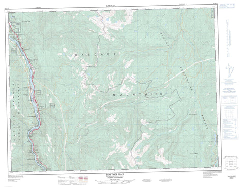
092H14 Boston Bar Canada topo map, 1:50,000 scale
092H14 Boston Bar NRCAN topographic map.
Includes UTM and GPS geographic coordinates (latitude and longitude). This 50k scale map is suitable for hiking, camping, and exploring, or you could frame it as a wall map.
Printed on-demand using high resolution, on heavy weight and acid free paper, or as an upgrade on a variety of synthetic materials.
Topos available on paper, Waterproof, Poly, or Tyvek. Usually shipping rolled, unless combined with other folded maps in one order.
- Product Number: NRCAN-092H14
- Parent Topo: TOPO-092H
- Map ID also known as: 092H14, 92H14
- Unfolded Size: Approximately 26" high by 36" wide
- Weight (paper map): ca. 55 grams
- Map Type: POD NRCAN Topographic Map
- Map Scale: 1:50,000
- Geographical region: British Columbia, Canada
Neighboring Maps:
All neighboring Canadian topo maps are available for sale online at 1:50,000 scale.
Purchase the smaller scale map covering this area: Topo-092H
Spatial coverage:
Topo map sheet 092H14 Boston Bar covers the following places:
- Boston Bar - Austin's Flat Indian Reserve 3 - Boothroyd Indian Reserve 13 - Boothroyd Indian Reserve 5A - Boothroyd Indian Reserve 5B - Boothroyd Indian Reserve 5C - Boothroyd Indian Reserve 6A - Boston Bar Indian Reserve 10 - Boston Bar Indian Reserve 11 - Boston Bar Indian Reserve 1A - Boston Bar Indian Reserve 8 - Boston Bar Indian Reserve 9 - Bucktum Indian Reserve 4 - Chaumox Indian Reserve 11 - Inkahtsaph Indian Reserve 6 - Kahmoose Indian Reserve 4 - Kopchitchin Indian Reserve 2 - Paul's Indian Reserve 6 - Réserve indienne Austin's Flat 3 - Réserve indienne Boothroyd 13 - Réserve indienne Boothroyd 5A - Réserve indienne Boothroyd 5B - Réserve indienne Boothroyd 5C - Réserve indienne Boothroyd 6A - Réserve indienne Boston Bar 10 - Réserve indienne Boston Bar 11 - Réserve indienne Boston Bar 1A - Réserve indienne Boston Bar 8 - Réserve indienne Boston Bar 9 - Réserve indienne Bucktum 4 - Réserve indienne Chaumox 11 - Réserve indienne Inkahtsaph 6 - Réserve indienne Kahmoose 4 - Réserve indienne Kopchitchin 2 - Réserve indienne Paul's 6 - Réserve indienne Sam Adams 12 - Réserve indienne Scaucy 5 - Réserve indienne Sho-ook 5 - Réserve indienne Shrypttahooks 7 - Réserve indienne Speyum 3 - Réserve indienne Tsawawmuck 1 - Réserve indienne Tsintahktl 2 - Réserve indienne Tuckkwiowhum 1 - Réserve indienne Yelakin 4A - Sam Adams Indian Reserve 12 - Scaucy Indian Reserve 5 - Sho-ook Indian Reserve 5 - Shrypttahooks Indian Reserve 7 - Speyum Indian Reserve 3 - Tsawawmuck Indian Reserve 1 - Tsintahktl Indian Reserve 2 - Tuckkwiowhum Indian Reserve 1 - Yelakin Indian Reserve 4A - Cabin Lake - Fishblue Lake - Lightning Lake - Murray Lake - Scuzzy Lake - Silver Lake - Cascade Mountains - Chaîne Côtière - Coast Mountains - Mount Stoyoma - Pacific Ranges - Stoyoma Mountain - Stoyoma Mountains - Fraser Valley Regional District - Regional District of Fraser-Cheam - Thompson Plateau - Scuzzy Rapids - Ainslie Creek - Anderson River - Bottletop Creek - Brunswick Creek - Bucktum Creek - Buctum Creek - Busteed Creek - Coldwater River - Cosar Creek - East Anderson River - Fleuve Fraser - Fraser River - Gowen Creek - Hallecks Creek - Hallisey Creek - Jamieson Creek - Maka Creek - Nepopulchin Creek - Nine Mile Creek - Ninemile Creek - Petch Creek - Scuzzy Creek - Scuzzy River - Six Mile Creek - Speyum Creek - Spius Creek - Stoyoma Creek - Terence Creek - Tsileuh Creek - Uztlius Creek - Uztlius River - China Bar Tunnel - Ferrabee Tunnel - Hells Gate Tunnel - China Bar - Ades - Boothroyd - Boston Bar - Canyon Alpine - Chaumox - China Bar - Gorge - Hells Gate - Hicks - Komo - Martinson - North Bend - Black Canyon - Hells Gate


