
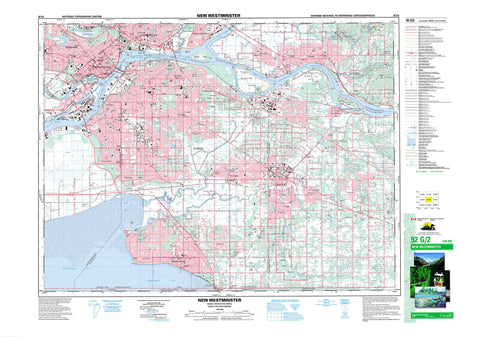
092G02 New Westminster Canada topo map, 1:50,000 scale
092G02 New Westminster NRCAN topographic map.
Includes UTM and GPS geographic coordinates (latitude and longitude). This 50k scale map is suitable for hiking, camping, and exploring, or you could frame it as a wall map.
Printed on-demand using high resolution, on heavy weight and acid free paper, or as an upgrade on a variety of synthetic materials.
Topos available on paper, Waterproof, Poly, or Tyvek. Usually shipping rolled, unless combined with other folded maps in one order.
- Product Number: NRCAN-092G02
- Parent Topo: TOPO-092G
- Map ID also known as: 092G02, 92G2, 92G02
- Unfolded Size: Approximately 26" high by 36" wide
- Weight (paper map): ca. 55 grams
- Map Type: POD NRCAN Topographic Map
- Map Scale: 1:50,000
- Geographical region: British Columbia, Canada
Neighboring Maps:
All neighboring Canadian topo maps are available for sale online at 1:50,000 scale.
Purchase the smaller scale map covering this area: Topo-092G
Spatial coverage:
Topo map sheet 092G02 New Westminster covers the following places:
- Boundary Bay - Mud Bay - North Arm - North Arm Fraser River - North Arm of Fraser River - Semiahmoo Bay - Semiamu Bay - Sapperton Bar - Blackie Spit - Endsleigh Point - Helmcken Point - Kwomais Point - Mann Point - Purfleet Point - Robert Point - Sebastian Point - Shoal Point - Tavistock Point - Annacis Channel - Annieville Channel - Bedford Channel - Parsons Channel - Sapperton Channel - Langley - New Westminster - Pitt Meadows - Port Coquitlam - Surrey - White Rock - Delta - Langley - Maple Ridge - New Westminster Land District - Annieville Dyke - Barnston Island Indian Reserve 3 - Coquitlam Indian Reserve 1 - Coquitlam Indian Reserve 2 - Graveyard Indian Reserve 5 - Katzie Indian Reserve 1 - Katzie Indian Reserve 2 - Langley Indian Reserve 5 - McMillan Island Indian Reserve 6 - Réserve indienne Barnston Island 3 - Réserve indienne Coquitlam 1 - Réserve indienne Coquitlam 2 - Réserve indienne Graveyard 5 - Réserve indienne Katzie 1 - Réserve indienne Katzie 2 - Réserve indienne Langley 5 - Réserve indienne McMillan Island 6 - Réserve indienne Semiahmoo - Semiahmoo Indian Reserve - Annacis Island - Barnston Island - Brae Island - Don Island - Douglas Island - Essondale Islet - Lion Island - Lulu Island - McMillan Island - Patrick Island - Poplar Island - Tree Island - Burnaby Lake - Cook Slough - Cranberry Slough - Deer Lake - Gundersen Slough - Katzie Slough - Latimer Pond - Tulley Slough - Canadian Forces Station Aldergrove - Station des Forces canadiennes Aldergrove - Connaught Hill - Grant Hill - Mary Hill - Central Fraser Valley Regional District - Dewdney-Alouette Regional District - Fort Langley National Historic Site of Canada - Golden Ears Park - Lieu historique national du Canada du Fort-Langley - Peace Arch Park - British Columbia - Colombie-Britannique - Alouette River - Anderson Creek - Austin Creek - Baker Creek - Barker Creek - Bertrand Creek - Best Creek - Booth Creek - Brunette River - Campbell Creek - Campbell River - Cave Creek - Chantrell Creek - Coghlan Creek - Como Creek - Coquitlam River - Cougar Canyon Creek - Damsite Creek - Elgin Creek - Elgin Creek - Fergus Creek - Fleuve Fraser - Fraser River - Hyland Creek - Kanaka Creek - Langley Creek - Latimer Creek - Lay Creek - Macdonald Brook - MacDonald Creek - Mackereth Creek - Mahood Creek - McInnis Creek - McKenny Creek - Muckle Creek - Munday Creek - Murray Creek - Nelson Creek - Newlands Brook - Nicomekl River - North Alouette River - Old Sawmill Creek - Palmateer Creek - Pitt River - Pleasantdale Creek - Quibble Creek - Salmon River - Sam Hill Creek - Serpentine River - Spencer Creek - Still Creek - Stoney Creek - Tyre Creek - West Creek - Willock Brook - Yorkson Creek - Bishops Reach - Chatham Reach - City Reach - Derby Reach - Queens Reach - Russel Reach - City Bank - Albion - Annacis - Anniedale - Annieville - Austin Heights - Barnston Island - Bridgeview - Brookswood - Brownsville - Brunette Creek - Buckingham Heights - Burke Road - Burnaby - Byrne Road - Cariboo - Cariboo Road - Cloverdale - Coghlan - Colebrook - Connaught Heights - Craigs - Crescent - Crescent - Crescent Beach - Dartmoor - Douglas - East Burnaby - Eastburn - Edmonds - Elgin - Elsona - Endot - Essondale - Ewen Junction - Fern Ridge - Fleetwood - Forest Knolls - Fort Langley - Fraser Arm - Fraser Heights - Fraser Mills - Fraser River Junction - Fraser Surrey - Glenbrooke North - Grandview - Guildford - Gyproc - Hammond - Haney - Hazelmere - Hopington - Hydro - Inverholm - Johnson Heights - Jubilee - Kelvin - Kennedy - Kings - Liverpool - Livingstone - Maillardville - Mary Hill - Mayfair - McGregor - McPherson Avenue - Meridian - Metrotown - Middlegate - Milner - Mud Bay - Murrayville - Newton - Newton Station - North Delta - North Surrey - North Surrey (Whalley Comm.-Aggl.) - Ocean Park - Panorama Ridge - Pitt Meadows - Pitt River - Port Hammond - Port Haney - Port Kells - Port Mann - Pratt - Queens Park - Queensborough - Rawlison - Royal Oak - Sapperton - Shops - South Burnaby - South Surrey - South Westminster - Sperling - Sperling Station - Sprott - Strawberry Hill - Sullivan - Sunbury - Sunnyside - Sunshine Hills - Surrey - Surrey Centre - Thornton Yard - Townsend - Trapp Road - Tynehead - Walnut Grove - Webster Corners - Websters Corners - West End - Westlang - Westminster - Whalley - Yennadon - Burns Bog


