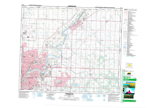
083H11 Edmonton Canada topo map, 1:50,000 scale
083H11 Edmonton NRCAN topographic map.
Includes UTM and GPS geographic coordinates (latitude and longitude). This 50k scale map is suitable for hiking, camping, and exploring, or you could frame it as a wall map.
Printed on-demand using high resolution, on heavy weight and acid free paper, or as an upgrade on a variety of synthetic materials.
Topos available on paper, Waterproof, Poly, or Tyvek. Usually shipping rolled, unless combined with other folded maps in one order.
- Product Number: NRCAN-083H11
- Parent Topo: TOPO-083H
- Map ID also known as: 083H11, 83H11
- Unfolded Size: Approximately 26" high by 36" wide
- Weight (paper map): ca. 55 grams
- Map Type: POD NRCAN Topographic Map
- Map Scale: 1:50,000
- Geographical region: Alberta, Canada
Neighboring Maps:
All neighboring Canadian topo maps are available for sale online at 1:50,000 scale.
Purchase the smaller scale map covering this area: Topo-083H
Spatial coverage:
Topo map sheet 083H11 Edmonton covers the following places:
- Edmonton - Fort Saskatchewan - Ball Lake - Bennett Lake - Boag Lake - Kelsey Lake - County of Strathcona No. 20 - Municipal District of Sturgeon No. 90 - Strathcona County - Sturgeon County - Obed Lake Provincial Park - Rutherford House Provincial Historic Site (Developed) - Strathcona Archaeological Centre Provincial Historic Site (Developed) - Strathcona Science Park - Astotin Creek - Fulton Creek - Horsehills Creek - Mill Creek - North Saskatchewan River - Oldman Creek - Pointe-aux-Pins Creek - Rivière Saskatchewan Nord - Ross Creek - Sturgeon River - Abbottsfield - Akenside - Alberta Avenue - Allendale - Ardrossan - Argyll - Avonmore - Balwin - Bannerman - Baturyn - Beacon Heights - Beacon Heights - Beaumaris - Bellevue - Belmont - Belvedere - Bergman - Beverly - Beverly Heights - Bonnie Doon - Boyle Street - Bremner - Bretville Junction - Campbell Park - Campbelltown - Capilano - Casselman - Central McDougall - Clover Bar - Cloverdale - Coronet Additional Industrial - Cromdale - Davies Industrial East - Davies Industrial West - Delton - Delwood - Duagh - Dunbar - East Edmonton - Eastwood - Elmwood Park - Evansdale - Forest Heights - Fulton Place - Gainer Industrial - Girard Industrial - Glengarry - Gold Bar - Griesbach - Hairsine - Hazeldean - Highlands - Holyrood - Homesteader - Horse Hill - Idylwylde - Industrial Heights - Josephburg - Kenilworth - Kennedale Industrial - Kernohan - Kildare - Kilkenny - Killarney - King Edward Park - Lambton Industrial - Lambton Park - Lamoureux - Lancaster Park - Lauderdale - Lorelei - Maple Ridge - McCauley - McIntyre Industrial - McLeod - Montrose - Morris Industrial - Namao - Newton - North Edmonton - Northmount - Norwood - Oliver - Ottewell - Overlanders - Parkdale - Partridge Hill - Pylypow Industrial - Queen Alexandra - Ritchie - River Bend - Riverbend - Riverdale - Roper Industrial - Rossdale - Rosslyn - Rundle Heights - Sherwood Park - Sifton Park - Simmons - Spruce Avenue - St. Paul Junction - Strathcona - Strathearn - Terrace Heights - Terrace Heights - Virginia Park - Weir Industrial - Westwood - Whitecroft - Wyeclif - York


