
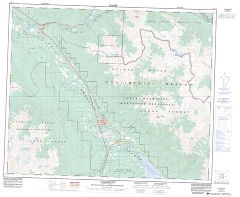
083D14 Valemount Canada topo map, 1:50,000 scale
083D14 Valemount NRCAN topographic map.
Includes UTM and GPS geographic coordinates (latitude and longitude). This 50k scale map is suitable for hiking, camping, and exploring, or you could frame it as a wall map.
Printed on-demand using high resolution, on heavy weight and acid free paper, or as an upgrade on a variety of synthetic materials.
Topos available on paper, Waterproof, Poly, or Tyvek. Usually shipping rolled, unless combined with other folded maps in one order.
- Product Number: NRCAN-083D14
- Parent Topo: TOPO-083D
- Map ID also known as: 083D14, 83D14
- Unfolded Size: Approximately 26" high by 36" wide
- Weight (paper map): ca. 55 grams
- Map Type: POD NRCAN Topographic Map
- Map Scale: 1:50,000
- Geographical region: British Columbia, Canada
Neighboring Maps:
All neighboring Canadian topo maps are available for sale online at 1:50,000 scale.
Purchase the smaller scale map covering this area: Topo-083D
Spatial coverage:
Topo map sheet 083D14 Valemount covers the following places:
- Rearguard Falls - Cranberry Lake - Kinbasket Lake - Little Cranberry Lake - Alpland Ridge - Cariboo Mountains - Columbia Mountains - Emerald Ridge - Klapperhorn Mountain - Malton Range - Monashee Mountains - Mount McKirdy - Mount Pierre Elliott Trudeau - Mount Terry Fox - Overlander Mountain - Park Ranges - Premier Range - Selwyn Range - Cariboo Regional District - Regional District of Fraser-Fort George - Jackman Flats Park - Mount Robson Park - Mount Terry Fox Park - Rearguard Falls Park - Barrett Creek - Camp Creek - Canoe River - Cochrane Creek - Cranberry Creek - Crooked Creek - Dave Henry Creek - Fleuve Fraser - Fraser River - Goslin Creek - Hogan Creek - Home Creek - Hystad Creek - L'Estrange Creek - L'Heureux Creek - Marathon Creek - McKirdy Creek - McLennan River - Packsaddle Creek - Selkirk Creek - Snowcourse Creek - Swift Creek - Tapli Creek - Teepee Creek - Terry Fox Creek - Tête Creek - West Cranberry Creek - Canoe Reach - Cedarside - Charles - Harvey - Jackman - Lubin - McCabe - Morey - Peterson - Rearguard - Red Pass - Red Pass Junction - Redpass Junction - Spicer - Swift Creek - Swiftwater - Taverna - Tête Jaune - Tête Jaune Cache - Von Zuben - Red Pass - Robson Valley - Rocky Mountain Trench - Valemount


