
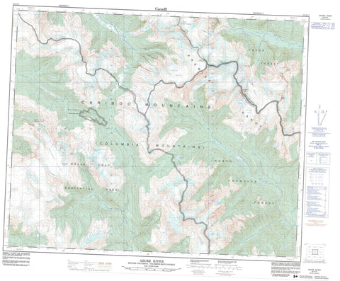
083D12 Azure River Canada topo map, 1:50,000 scale
083D12 Azure River NRCAN topographic map.
Includes UTM and GPS geographic coordinates (latitude and longitude). This 50k scale map is suitable for hiking, camping, and exploring, or you could frame it as a wall map.
Printed on-demand using high resolution, on heavy weight and acid free paper, or as an upgrade on a variety of synthetic materials.
Topos available on paper, Waterproof, Poly, or Tyvek. Usually shipping rolled, unless combined with other folded maps in one order.
- Product Number: NRCAN-083D12
- Parent Topo: TOPO-083D
- Map ID also known as: 083D12, 83D12
- Unfolded Size: Approximately 26" high by 36" wide
- Weight (paper map): ca. 55 grams
- Map Type: POD NRCAN Topographic Map
- Map Scale: 1:50,000
- Geographical region: British Columbia, Canada
Neighboring Maps:
All neighboring Canadian topo maps are available for sale online at 1:50,000 scale.
Purchase the smaller scale map covering this area: Topo-083D
Spatial coverage:
Topo map sheet 083D12 Azure River covers the following places:
- Black Nun Falls - Braithwaite Falls - Blackstone Glacier - Braithwaite Glacier - Braithwaite Icefield - Chamberlin Glacier - David Glacier - North Canoe Glacier - Raush Glacier - South Canoe Glacier - Thompson Glacier - Zillmer Glacier - McAndrew Lake - Zero Lake - Cariboo Mountains - Chamberlin Peak - Chilkst Peaks - Columbia Mountains - Mount Carpé - Mount Sir John Thompson - Mount Withers - Mount Zillmer - Premier Range - Trigon Mountain - Cariboo Regional District - Regional District of Fraser-Fort George - Wellesley Gray Recreation Area - Wells Gray Park - Wells Gray Recreation Area - Argyle Creek - Azure River - Blackstone Creek - Bois Grenier Creek - Braithwaite Creek - Davehenry Creek - Davis Creek - East Creek - Ella Frye Creek - Erethizon Creek - Fred Wells Creek - Hobson Creek - Knutson Creek - Lebher Creek - McAndrew Creek - North Thompson River - Pleasant Creek - Raush River - St. Julien Creek - Stormking Creek - Warcolt Creek - Zillmer Creek


