
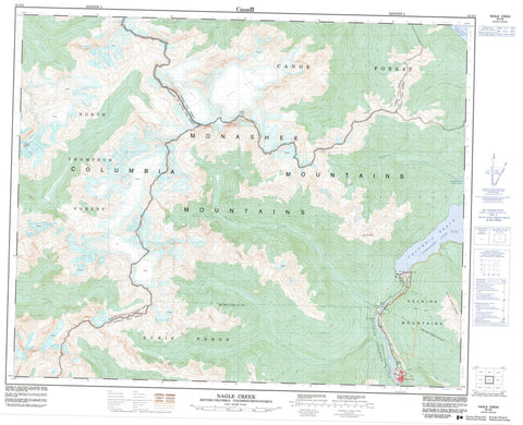
083D02 Nagle Creek Canada topo map, 1:50,000 scale
083D02 Nagle Creek NRCAN topographic map.
Includes UTM and GPS geographic coordinates (latitude and longitude). This 50k scale map is suitable for hiking, camping, and exploring, or you could frame it as a wall map.
Printed on-demand using high resolution, on heavy weight and acid free paper, or as an upgrade on a variety of synthetic materials.
Topos available on paper, Waterproof, Poly, or Tyvek. Usually shipping rolled, unless combined with other folded maps in one order.
- Product Number: NRCAN-083D02
- Parent Topo: TOPO-083D
- Map ID also known as: 083D02, 83D2, 83D02
- Unfolded Size: Approximately 26" high by 36" wide
- Weight (paper map): ca. 55 grams
- Map Type: POD NRCAN Topographic Map
- Map Scale: 1:50,000
- Geographical region: British Columbia, Canada
Neighboring Maps:
All neighboring Canadian topo maps are available for sale online at 1:50,000 scale.
Purchase the smaller scale map covering this area: Topo-083D
Spatial coverage:
Topo map sheet 083D02 Nagle Creek covers the following places:
- Foster Glacier - Hallam Glacier - Mica Dam - Kinbasket Lake - Lake Revelstoke - Little Chief Lake - Big Bend Ranges - Columbia Mountains - Dutchman's Ridge - Fred Laing Ridge - French Peaks - Hallam Peak - Little Chief Ridge - Monashee Mountains - Mount Nagle - Selkirk Mountains - Cariboo Regional District - Columbia-Shuswap Regional District - Regional District of Fraser-Fort George - Adams River - Columbia River - Dutchman's Creek - Encampment Creek - Foster Creek - Franchère Creek - Gorge Creek - Little Chief Creek - Mica Creek - Mud Creek - Nagle Creek - Potlatch Creek - Soards Creek - West Foster Creek - Canoe Reach - Columbia Reach - Mica Creek


