
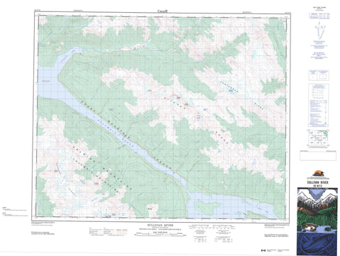
082N13 Sullivan River Canada topo map, 1:50,000 scale
082N13 Sullivan River NRCAN topographic map.
Includes UTM and GPS geographic coordinates (latitude and longitude). This 50k scale map is suitable for hiking, camping, and exploring, or you could frame it as a wall map.
Printed on-demand using high resolution, on heavy weight and acid free paper, or as an upgrade on a variety of synthetic materials.
Topos available on paper, Waterproof, Poly, or Tyvek. Usually shipping rolled, unless combined with other folded maps in one order.
- Product Number: NRCAN-082N13
- Parent Topo: TOPO-082N
- Map ID also known as: 082N13, 82N13
- Unfolded Size: Approximately 26" high by 36" wide
- Weight (paper map): ca. 55 grams
- Map Type: POD NRCAN Topographic Map
- Map Scale: 1:50,000
- Geographical region: British Columbia, Canada
Neighboring Maps:
All neighboring Canadian topo maps are available for sale online at 1:50,000 scale.
Purchase the smaller scale map covering this area: Topo-082N
Spatial coverage:
Topo map sheet 082N13 Sullivan River covers the following places:
- Bush Arm - Double Eddy Bay - Game Bay - Kinbasket Arm - Smith Bay - Succour Arm - Sullivan Arm - Swan Bay - Ed Falls Glacier - Gothics Glacier - Granite Glacier - Bush Lake - Kinbasket Lake - Adamant Range - Ambleside Peak - Big Bend Ranges - Columbia Mountains - Doubletop Mountain - Houdini Needles - Kitchen Range - Lid Mountain - Montagnes Rocheuses - Mount Damon - Mount Ed Falls - Mount Pythias - Park Ranges - Poker Mountain - Rocky Mountains - Selkirk Mountains - Solitude Mountain - Sophist Mountain - Stovepipe Mountain - Tabernacle Mountain - Vertebrae Mountain - Vertebrae Ridge - Columbia-Shuswap Regional District - Regional District of Kootenay-Boundary - Surprise Rapids - Austerity Creek - Caribou Creek - Chatter Creek - Columbia River - Double Eddy Creek - Fleuve Columbia - Game Creek - Garrett Creek - Kinbasket Creek - Kinbasket River - Little Foster Creek - Middle River - Nixon Creek - Prattle Creek - Shell Creek - Smith Creek - Sullivan River - Swan Creek - Tabernacle Creek - Columbia Reach - The Elbow - Sentinel Rock - Rocky Mountain Trench - Fairy Meadow


