
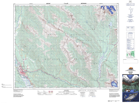
082N07 Golden Canada topo map, 1:50,000 scale
082N07 Golden NRCAN topographic map.
Includes UTM and GPS geographic coordinates (latitude and longitude). This 50k scale map is suitable for hiking, camping, and exploring, or you could frame it as a wall map.
Printed on-demand using high resolution, on heavy weight and acid free paper, or as an upgrade on a variety of synthetic materials.
Topos available on paper, Waterproof, Poly, or Tyvek. Usually shipping rolled, unless combined with other folded maps in one order.
- Product Number: NRCAN-082N07
- Parent Topo: TOPO-082N
- Map ID also known as: 082N07, 82N7, 82N07
- Unfolded Size: Approximately 26" high by 36" wide
- Weight (paper map): ca. 55 grams
- Map Type: POD NRCAN Topographic Map
- Map Scale: 1:50,000
- Geographical region: British Columbia, Canada
Neighboring Maps:
All neighboring Canadian topo maps are available for sale online at 1:50,000 scale.
Purchase the smaller scale map covering this area: Topo-082N
Spatial coverage:
Topo map sheet 082N07 Golden covers the following places:
- Hamilton Falls - Magnificent Cascade - Oreamnos Cascade - Emerald Glacier - Hanbury Glacier - Cedar Lake - Emerald Lake - Hamilton Lake - Little Gem Lake - Lone Duck Lake - Peaceful Pond - Snowdrift Lake - Beaverfoot Range - Burnt Hill - Columbia Mountains - Emerald Peak - Hamilton Ridge - Hamilton Spur - Kiwetinok Ridge - Kootenay Ranges - Langford Peak - Michael Peak - Moberly Peak - Montagnes Rocheuses - Mount Burgess - Mount Carnarvon - Mount Deville - Mount Ennis - Mount Horsey - Mount Hunter - Mount Hurd - Mount King - Mount Marpole - Mount McBeath - Mount Vaux - Ottertail Range - Porcupine Peak - President Range - Purcell Mountains - Redburn Peak - Rocky Mountains - Sea Shoal Mountain - Spike Peak - The President - Tocher Ridge - Van Horne Range - Walcott Peak - Columbia-Shuswap Regional District - Regional District of Kootenay-Boundary - Golden Park - Parc national du Canada Yoho - Yoho National Park of Canada - Amiskwi River - Blaeberry River - Boulder Creek - Cedar Creek - Columbia River - Edelweiss Creek - Emerald River - Fire Creek - Fleuve Columbia - Frenchman Creek - Giddie Creek - Glenogle Creek - Hamilton Creek - Haygarth Creek - Hedberg Creek - Hospital Creek - Kendel Creek - Kicking Horse River - Kiwetinok River - McBeath Creek - Moberly Creek - Oreamnos Creek - Otterhead River - Ottertail River - Otto Creek - Polecabin Creek - Porcupine Creek - Redburn Creek - Russell Creek - Snowdrift Creek - South Hospital Creek - Split Creek - Stacey Creek - Willowbank Creek - Golden - Cloister - Cutbank - Edelweiss - Glenogle - Misko - Ottertail - Palliser - Emerald Pass - Hurd Pass - Kiwetinok Valley - Lower Canyon - Rocky Mountain Trench


