
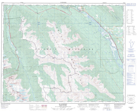
082N06 Blaeberry Canada topo map, 1:50,000 scale
082N06 Blaeberry NRCAN topographic map.
Includes UTM and GPS geographic coordinates (latitude and longitude). This 50k scale map is suitable for hiking, camping, and exploring, or you could frame it as a wall map.
Printed on-demand using high resolution, on heavy weight and acid free paper, or as an upgrade on a variety of synthetic materials.
Topos available on paper, Waterproof, Poly, or Tyvek. Usually shipping rolled, unless combined with other folded maps in one order.
- Product Number: NRCAN-082N06
- Parent Topo: TOPO-082N
- Map ID also known as: 082N06, 82N6, 82N06
- Unfolded Size: Approximately 26" high by 36" wide
- Weight (paper map): ca. 55 grams
- Map Type: POD NRCAN Topographic Map
- Map Scale: 1:50,000
- Geographical region: British Columbia, Canada
Neighboring Maps:
All neighboring Canadian topo maps are available for sale online at 1:50,000 scale.
Purchase the smaller scale map covering this area: Topo-082N
Spatial coverage:
Topo map sheet 082N06 Blaeberry covers the following places:
- Bear Creek Falls - Avalanche Glacier - Eagle Glacier - Hermit Glacier - Illecillewaet Névé - Sir Donald Glacier - Tupper Glacier - Uto Glacier - Vaux Glacier - Cabin Lake - Cooper Lake - Dejordy Lake - Deserted Lake - Wiseman Lakes - Avalanche Crest - Avalanche Mountain - Bald Mountain - Bald Ridge - Big Bend Ranges - Columbia Mountains - Copperstain Mountain - Dauntless Mountain - Dawn Mountain - Dogtooth Range - Eagle Peak - Heather Mountain - Moonraker Peak - Mount Hughes - Mount Macdonald - Mount Sir Donald - Mount Tupper - Perley Rock - Prairie Hills - Purcell Mountains - Selkirk Mountains - Sir Donald Range - Terminal Peak - The Overlook - Uto Peak - Whitetooth - Willowbank Mountain - Columbia-Shuswap Regional District - Regional District of Kootenay-Boundary - Burges and James Gadsden Park - Glacier National Park of Canada - Marl Creek Park - Parc national du Canada des Glaciers - Alder Creek - Asulkan Brook - Avalanche Creek - Baird Brook - Beaver River - Blaeberry River - Bryants Creek - Cabin Creek - Canyon Creek - Cascade Creek - Cedar Creek - Cirque Creek - Colepitts Creek - Columbia River - Connaught Creek - Copperstain Creek - Cupola Creek - Cut Creek - Dejordy Creek - Donald Creek - Doyle Creek - East Grizzly Creek - Fleuve Columbia - Goat Mountain Creek - Gorman Creek - Grizzly Creek - Heather Creek - Holt Creek - Illecillewaet River - Jones Creek - Lang Creek - Moberly Creek - Mountain Creek - Neale Creek - Oldman Creek - Polecabin Creek - Quartz Creek - Shaughnessy Creek - South Canyon Creek - Spillimacheen River - Stoney Creek - Stony Creek - Sturdee Creek - Surprise Creek - Tupper Creek - Waitabit Creek - Willowbank Creek - Wiseman Creek - Connaught Tunnel - Mount Macdonald Tunnel - Mount Shaughnessy Tunnel - Bear Creek - Blaeberry - Connaught - Cutbank - Donald - Donald Station - East Gate - Forde - Fraine - Griffith - Kicking Horse - Moberly - Rogers - Spruceville (Rogers Sett.-Étab.) - Stoney Creek - Sturdee - Wakely - Donald Canyon - Rocky Mountain Trench - Moberly Marsh


