
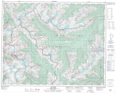
082N05 Glacier Canada topo map, 1:50,000 scale
082N05 Glacier NRCAN topographic map.
Includes UTM and GPS geographic coordinates (latitude and longitude). This 50k scale map is suitable for hiking, camping, and exploring, or you could frame it as a wall map.
Printed on-demand using high resolution, on heavy weight and acid free paper, or as an upgrade on a variety of synthetic materials.
Topos available on paper, Waterproof, Poly, or Tyvek. Usually shipping rolled, unless combined with other folded maps in one order.
- Product Number: NRCAN-082N05
- Parent Topo: TOPO-082N
- Map ID also known as: 082N05, 82N5, 82N05
- Unfolded Size: Approximately 26" high by 36" wide
- Weight (paper map): ca. 55 grams
- Map Type: POD NRCAN Topographic Map
- Map Scale: 1:50,000
- Geographical region: British Columbia, Canada
Neighboring Maps:
All neighboring Canadian topo maps are available for sale online at 1:50,000 scale.
Purchase the smaller scale map covering this area: Topo-082N
Spatial coverage:
Topo map sheet 082N05 Glacier covers the following places:
- Nakimu Caves - Bear Falls - Douglas Falls - Goat Falls - Gopher Falls - Whistler Falls - Cougar Glacier - Dismal Glacier - Durand Glacier - Durrand Glacier - Fang Glacier - Hermit Glacier - Hickson Glacier - Rogers Glacier - Shaughnessy Glacier - Sorcerer Glacier - Swiss Glacier - Tupper Glacier - Downie Lake - Marion Lake - Ventego Lake - Bagheera Mountain - Big Bend Ranges - Catamount Peak - Cheops Mountain - Christiana Ridge - Clachnacudainn Range - Columbia Mountains - Copper Peak - Copper Peaks - Corbin Peak - Cougar Mountain - Duncan Range - Fleming Peak - Grant Peak - Grey Fang - Grizzly Mountain - Hermit Mountain - Hermit Range - Iconoclast Mountain - Mount Anstey - Mount Baal - Mount Carson - Mount Durand - Mount Durrand - Mount Graham - Mount McGill - Mount McNicoll - Mount Moloch - Mount Pearce - Mount Rogers - Mount Shaughnessy - Mount Sifton - Mount Sissons - Mystic Mountain - Napoleon Spur - Nordic Mountain - Rogers Peak - Selkirk Mountains - Sorcerer Mountain - Swiss Peak - The Hermit - Truda Peaks - Tumbledown Mountain - Ursus Major Mountain - Ursus Minor Mountain - Wolverine Ridge - Columbia-Shuswap Regional District - Regional District of Kootenay-Boundary - Glacier National Park of Canada - Lieu historique national du Canada du Col-Rogers - Parc national du Canada des Glaciers - Rogers Pass National Historic Site of Canada - Alder Creek - Bachelor Creek - Benedict Creek - Carnes Creek - Casualty Creek - Connaught Creek - Cougar Brook - Cupola Creek - Cut Creek - Downie Creek - Fang Creek - Farm Creek - Holway Creek - Illecillewaet River - Loop Brook - Moloch Creek - Mountain Creek - Rogers Pass Creek - Shaughnessy Creek - Sorcerer Creek - Stoney Creek - Stony Creek - Sturdee Creek - Surprise Creek - Tangier River - Ursus Creek - Ventego Creek - Connaught Tunnel - Mount Macdonald Tunnel - Fang Rock - Glacier - Macdonald - Rogers Pass - Ross Peak - Balu Pass - Bostock Pass - Bruins Pass - Cougar Pass - Farm Pass - McGill Pass - Rogers Pass - Sorcerer Pass - Tangier Pass


