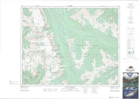
082N03 Mount Wheeler Canada topo map, 1:50,000 scale
082N03 Mount Wheeler NRCAN topographic map.
Includes UTM and GPS geographic coordinates (latitude and longitude). This 50k scale map is suitable for hiking, camping, and exploring, or you could frame it as a wall map.
Printed on-demand using high resolution, on heavy weight and acid free paper, or as an upgrade on a variety of synthetic materials.
Topos available on paper, Waterproof, Poly, or Tyvek. Usually shipping rolled, unless combined with other folded maps in one order.
- Product Number: NRCAN-082N03
- Parent Topo: TOPO-082N
- Map ID also known as: 082N03, 82N3, 82N03
- Unfolded Size: Approximately 26" high by 36" wide
- Weight (paper map): ca. 55 grams
- Map Type: POD NRCAN Topographic Map
- Map Scale: 1:50,000
- Geographical region: British Columbia, Canada
Neighboring Maps:
All neighboring Canadian topo maps are available for sale online at 1:50,000 scale.
Purchase the smaller scale map covering this area: Topo-082N
Spatial coverage:
Topo map sheet 082N03 Mount Wheeler covers the following places:
- Asulkan Glacier - Beaver Glacier - Black Glacier - Dawson Glacier - Deville Glacier - Deville Névé - Donkin Glacier - Duncan Glacier - Duncan Névé - Fox Glacier - Geikie Glacier - Grand Glacier - Grand Glaciers - Illecillewaet Glacier - Illecillewaet Névé - Odin Glacier - Purity Glacier - Spillimacheen Glacier - The Bishops Glacier - Thor Glacier - Van Horne Glacier - Van Horne Névé - Baird Lake - Butters Lake - Silent Lake - Asulkan Ridge - Augustine Peak - Bald Mountain - Bald Ridge - Battle Range - Beaver Mountain - Beaver Overlook - Beverly Peak - Caribou Peak - Castor Peak - Columbia Mountains - Cony Peak - Cyprian Peak - David Peak - Dawson Range - Dogtooth Range - Feuz Peak - Glacier Crest - Grand Mountain - Hasler Peak - Leda Peak - Lookout Mountain - Michel Peak - Mount Castor - Mount Dawson - Mount Donkin - Mount Duncan - Mount Fox - Mount Jupiter - Mount Kilpatrick - Mount Macoun - Mount Pollux - Mount Selwyn - Mount Topham - Mount Wheeler - Perley Rock - Pollux Peak - Pristine Mountain - Purcell Mountains - Purity Mountain - Purity Range - Schooner Ridge - Selkirk Mountains - Silent Mountain - Spillimacheen Mountain - Spillimacheen Range - Sugarloaf Mountain - The Bishops Range - The Witch Tower - Twin Towers Peak - Vestal Mountain - Youngs Peak - Columbia-Shuswap Regional District - Regional District of Central Kootenay - Regional District of Kootenay-Boundary - Glacier National Park of Canada - Parc national du Canada des Glaciers - Asulkan Brook - Baird Brook - Battle Brook - Beaver River - Bennison Creek - Black Creek - Bobbie Burns Creek - Butters Creek - Canyon Creek - Carbonate Creek - Caribou Creek - Duncan River - Incomappleux River - McLean Creek - McMurdo Creek - Mitre Creek - South Canyon Creek - Spillimacheen River - Twelve Mile Creek - Twisted Rock - McMurdo - Asulkan Pass - Donkin Pass - Glacier Circle - Purity Pass - Sapphire Col - Silent Pass


