
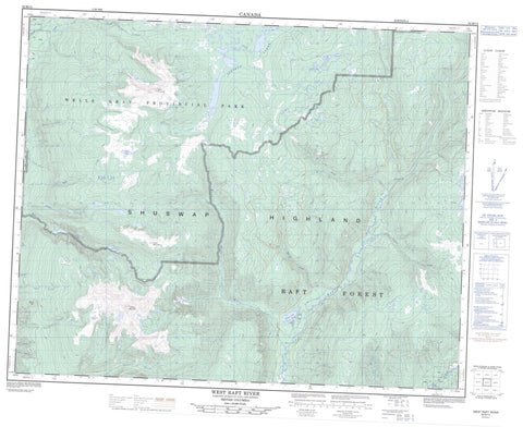
082M13 West Raft River Canada topo map, 1:50,000 scale
082M13 West Raft River NRCAN topographic map.
Includes UTM and GPS geographic coordinates (latitude and longitude). This 50k scale map is suitable for hiking, camping, and exploring, or you could frame it as a wall map.
Printed on-demand using high resolution, on heavy weight and acid free paper, or as an upgrade on a variety of synthetic materials.
Topos available on paper, Waterproof, Poly, or Tyvek. Usually shipping rolled, unless combined with other folded maps in one order.
- Product Number: NRCAN-082M13
- Parent Topo: TOPO-082M
- Map ID also known as: 082M13, 82M13
- Unfolded Size: Approximately 26" high by 36" wide
- Weight (paper map): ca. 55 grams
- Map Type: POD NRCAN Topographic Map
- Map Scale: 1:50,000
- Geographical region: British Columbia, Canada
Neighboring Maps:
All neighboring Canadian topo maps are available for sale online at 1:50,000 scale.
Purchase the smaller scale map covering this area: Topo-082M
Spatial coverage:
Topo map sheet 082M13 West Raft River covers the following places:
- Camp Lake - Fight Lake - Moul Lake - Philip Lake - Sheila Lake - Silence Lake - Skeeter Lake - Stevens Lakes - Battle Mountain - Buck Hill - Discovery Hill - Fiftytwo Ridge - Long Hill - Mount Philip - Shuswap Highland - Table Mountain - Trophy Mountain - Wellesley Gray Recreation Area - Wells Gray Park - Wells Gray Recreation Area - Interior Plateau - Battle Creek - Camp Creek - Clover Creek - Duncan Creek - Fage Creek - First Canyon Creek - Grouse (Moul) Creek - Hemp Creek - Mad Creek - Mad River - Martin Creek - Maxwell Creek - Moul Creek - Ordschig Creek - Philip Creek - Raft River - Richie Creek - Second Canyon Creek - Silence Creek - Snookwa Creek - Spahats Creek - Stratton Creek - Third Canyon Creek - Trout Creek - West Raft River - Herman Valley - Indian Valley - Shepherds Valley


