
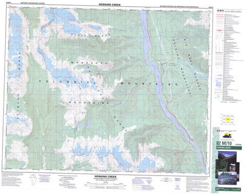
082M10 Hoskins Creek Canada topo map, 1:50,000 scale
082M10 Hoskins Creek NRCAN topographic map.
Includes UTM and GPS geographic coordinates (latitude and longitude). This 50k scale map is suitable for hiking, camping, and exploring, or you could frame it as a wall map.
Printed on-demand using high resolution, on heavy weight and acid free paper, or as an upgrade on a variety of synthetic materials.
Topos available on paper, Waterproof, Poly, or Tyvek. Usually shipping rolled, unless combined with other folded maps in one order.
- Product Number: NRCAN-082M10
- Parent Topo: TOPO-082M
- Map ID also known as: 082M10, 82M10
- Unfolded Size: Approximately 26" high by 36" wide
- Weight (paper map): ca. 55 grams
- Map Type: POD NRCAN Topographic Map
- Map Scale: 1:50,000
- Geographical region: British Columbia, Canada
Neighboring Maps:
All neighboring Canadian topo maps are available for sale online at 1:50,000 scale.
Purchase the smaller scale map covering this area: Topo-082M
Spatial coverage:
Topo map sheet 082M10 Hoskins Creek covers the following places:
- Kootenay Land District - Kirbyville Lake - Lake Revelstoke - Big Bend Ranges - Columbia Mountains - McLennan Peak - Monashee Mountains - Ratchford Range - Scrip Range - Selkirk Mountains - Seymour Range - Columbia-Shuswap Regional District - Upper Seymour River Park - Death Rapids - Twelve Mile Rapids - Twelvemile Rapids - Blais Creek - Bunty Creek - Columbia River - Fernie Creek - Fissure Creek - Fleuve Columbia - Gaffney Creek - Goldstream River - Hill Creek - Hiram Creek - Holden Creek - Hoskins Creek - Kirbyville Creek - Kitson Creek - Liberty Creek - Lund Creek - Mammoth Creek - McCulloch Creek - Nicholls Creek - Old Camp Creek - Old Goldstream Creek - Oliver Creek - Ratchford Creek - Ruddock Creek - Seven Mile Creek - Seymour River - Sibley Creek - Seymour Pass


