
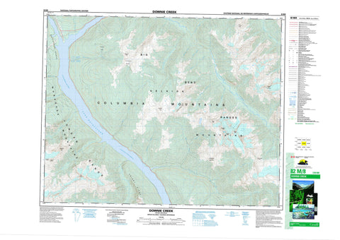
082M08 Downie Creek Canada topo map, 1:50,000 scale
082M08 Downie Creek NRCAN topographic map.
Includes UTM and GPS geographic coordinates (latitude and longitude). This 50k scale map is suitable for hiking, camping, and exploring, or you could frame it as a wall map.
Printed on-demand using high resolution, on heavy weight and acid free paper, or as an upgrade on a variety of synthetic materials.
Topos available on paper, Waterproof, Poly, or Tyvek. Usually shipping rolled, unless combined with other folded maps in one order.
- Product Number: NRCAN-082M08
- Parent Topo: TOPO-082M
- Map ID also known as: 082M08, 82M8, 82M08
- Unfolded Size: Approximately 26" high by 36" wide
- Weight (paper map): ca. 55 grams
- Map Type: POD NRCAN Topographic Map
- Map Scale: 1:50,000
- Geographical region: British Columbia, Canada
Neighboring Maps:
All neighboring Canadian topo maps are available for sale online at 1:50,000 scale.
Purchase the smaller scale map covering this area: Topo-082M
Spatial coverage:
Topo map sheet 082M08 Downie Creek covers the following places:
- Abyss Glacier - Bridgland Glacier - Carnes Glacier - Phogg Glacier - Lake Revelstoke - Belcher Ridge - Big Bend Ranges - Bridgland Peak - Carnes Peak - Columbia Mountains - Frenchman Cap - Frisby Ridge - Hat Peak - Jordan Range - Kelly Crest - Keystone Peak - Monashee Mountains - Mount Craib - Mount Holway - Mount Levers - Pass Peak - Phogg Peak - Roseberry Mountain - Selkirk Mountains - Standard Peak - Columbia-Shuswap Regional District - Eighteen Mile Rapids - Eighteenmile Rapids - Priest Rapids - Belcher Creek - Big Eddy Creek - Bigeddy Creek - Bourne Creek - Brown Creek - Burke Creek - Cap Creek - Caribou Creek - Carnes Creek - Columbia River - Downie Creek - Five Mile Creek - Fleuve Columbia - Fortynine Creek - Frisby Creek - Holdich Creek - Holway Creek - Kelly Creek - Keystone Creek - Mars Creek - McKinnon Creek - Murder Creek - Park Creek - Pass Creek - Pelkey Creek - Pettipiece Creek - Seymour Creek - Sorcerer Creek - Standard Creek - The Fortynine Creek - Tumbledown Creek - Downie Creek - Bridgland Pass - Keystone Basin - Levers Pass - Standard Basin


