
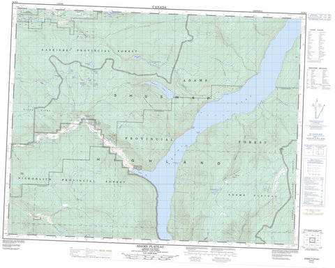
082M04 Adams Plateau Canada topo map, 1:50,000 scale
082M04 Adams Plateau NRCAN topographic map.
Includes UTM and GPS geographic coordinates (latitude and longitude). This 50k scale map is suitable for hiking, camping, and exploring, or you could frame it as a wall map.
Printed on-demand using high resolution, on heavy weight and acid free paper, or as an upgrade on a variety of synthetic materials.
Topos available on paper, Waterproof, Poly, or Tyvek. Usually shipping rolled, unless combined with other folded maps in one order.
- Product Number: NRCAN-082M04
- Parent Topo: TOPO-082M
- Map ID also known as: 082M04, 82M4, 82M04
- Unfolded Size: Approximately 26" high by 36" wide
- Weight (paper map): ca. 55 grams
- Map Type: POD NRCAN Topographic Map
- Map Scale: 1:50,000
- Geographical region: British Columbia, Canada
Neighboring Maps:
All neighboring Canadian topo maps are available for sale online at 1:50,000 scale.
Purchase the smaller scale map covering this area: Topo-082M
Spatial coverage:
Topo map sheet 082M04 Adams Plateau covers the following places:
- Agate Bay - Skwaam Bay - Cottonwood Point - Hindu Point - Tshinakin Point - White Bluffs - Silverspray Falls - Réserve indienne Squaam 2 - Squaam Indian Reserve 2 - Adams Lake - Dixon Lake - East Barrière Lake - Fadear Lake - Forest Lake - Gilfrid Lake - Johnson Lake - Little Dixon Lake - Long Lake - Mains Lake - Needmore Lake - Nikwikwaia Lakes - Sams Lake - Saunders Lake - Shafer Lake - South Barrière Lake - Upper South Barrière Lake - Dixon Mountains - Dixon Ridge - Mount Fadear - Pisima Mountain - Samatosum Mountain - Shuswap Highland - Adams Lake - Poplar Point Park - Adams Lake Marine Park - Spillman Beaches Park - Adams Plateau - Interior Plateau - Alex Creek - Athelstan Creek - Barriere River - Barrière River - Blomley Creek - Bowler Creek - Brennan Creek - Bugcamp Creek - Bush Creek - Chip Creek - Cicero Creek - Dixon Creek - East Barrière River - Eberts Creek - Fadear Creek - Fir Creek - Fraser Creek - Haggard Creek - Homestake Creek - Johnson Creek - Lime Creek - Nikwikwaia Creek - North Cicero Creek - Samatosum Creek - Sinmax Creek - Spapilem Creek - Spillman Creek - Wikiup Creek - Woolford Creek - Henstridge Meadow - Wards Meadow


